This weather event on July 23, 2025 includes:
3 states
21 counties,
29 cities,
and 72 zip codes.
There were total properties that were impacted and have possible damage.
States Impacted By Hail On July 23, 2025
Illinois
·
Kentucky
·
Missouri
Counties Impacted By Hail On July 23, 2025
Clay, IL
·
Effingham, IL
·
Fayette, IL
·
Franklin, IL
·
Hamilton, IL
·
Jackson, IL
·
Jefferson, IL
·
Johnson, IL
·
Macon, IL
·
Marion, IL
·
Piatt, IL
·
Pope, IL
·
Pulaski, IL
·
Saline, IL
·
Shelby, IL
·
Union, IL
·
Washington, IL
·
Wayne, IL
·
Williamson, IL
·
Ballard, KY
·
Perry, MO
Cities Impacted By Hail On July 23, 2025
Bandana, KY
·
Barlow, KY
·
Benton, IL
·
Cambria, IL
·
Carbondale, IL
·
Carterville, IL
·
Colp, IL
·
Crab Orchard, IL
·
Crainville, IL
·
Creal Springs, IL
·
Decatur, IL
·
Eddyville, IL
·
Energy, IL
·
Goreville, IL
·
Harrisburg, IL
·
Herrin, IL
·
Ina, IL
·
Long Creek, IL
·
Macedonia, IL
·
Marion, IL
·
Monticello, IL
·
Mount Vernon, IL
·
Muddy, IL
·
Nashville, IL
·
Odin, IL
·
Pittsburg, IL
·
Stewardson, IL
·
Strasburg, IL
·
Thompsonville, IL
Zip Codes Impacted By Hail On July 23, 2025
42024
·
42053
·
42056
·
61813
·
61818
·
61856
·
61957
·
62280
·
62418
·
62444
·
62458
·
62461
·
62463
·
62465
·
62501
·
62521
·
62526
·
62565
·
62812
·
62817
·
62837
·
62838
·
62846
·
62849
·
62854
·
62859
·
62860
·
62864
·
62870
·
62872
·
62881
·
62883
·
62884
·
62889
·
62890
·
62894
·
62895
·
62897
·
62899
·
62901
·
62902
·
62906
·
62912
·
62917
·
62918
·
62921
·
62922
·
62923
·
62924
·
62926
·
62928
·
62933
·
62934
·
62935
·
62938
·
62939
·
62946
·
62947
·
62948
·
62956
·
62958
·
62959
·
62965
·
62972
·
62974
·
62985
·
62987
·
62992
·
63775
·
42022
·
62263
·
62915
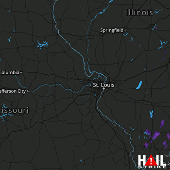 ST LOUIS (KLSX) RADAR

