This weather event on July 22, 2025 includes:
2 states
20 counties,
25 cities,
and 69 zip codes.
There were total properties that were impacted and have possible damage.
States Impacted By Hail On July 22, 2025
Iowa
·
Missouri
Counties Impacted By Hail On July 22, 2025
Appanoose, IA
·
Benton, IA
·
Butler, IA
·
Davis, IA
·
Grundy, IA
·
Hardin, IA
·
Iowa, IA
·
Jasper, IA
·
Keokuk, IA
·
Mahaska, IA
·
Marion, IA
·
Marshall, IA
·
Monroe, IA
·
Poweshiek, IA
·
Story, IA
·
Tama, IA
·
Van Buren, IA
·
Wapello, IA
·
Lewis, MO
·
Schuyler, MO
Cities Impacted By Hail On July 22, 2025
Baxter, IA
·
Belle Plaine, IA
·
Bloomfield, IA
·
Bussey, IA
·
Collins, IA
·
Colo, IA
·
Eldon, IA
·
Floris, IA
·
Grundy Center, IA
·
Hamilton, IA
·
Haverhill, IA
·
Holland, IA
·
Knoxville, IA
·
Lovilia, IA
·
Marshalltown, IA
·
Melbourne, IA
·
Mingo, IA
·
Monroe, IA
·
New Hartford, IA
·
Ottumwa, IA
·
Pella, IA
·
Rhodes, IA
·
Sigourney, IA
·
Valeria, IA
·
Zearing, IA
Zip Codes Impacted By Hail On July 22, 2025
50028
·
50044
·
50051
·
50054
·
50055
·
50056
·
50116
·
50119
·
50120
·
50122
·
50127
·
50143
·
50150
·
50158
·
50162
·
50168
·
50170
·
50206
·
50214
·
50219
·
50228
·
50234
·
50247
·
50256
·
50258
·
50278
·
50613
·
50621
·
50624
·
50627
·
50632
·
50635
·
50638
·
50642
·
50660
·
50665
·
52208
·
52215
·
52225
·
52231
·
52232
·
52249
·
52251
·
52347
·
52355
·
52501
·
52531
·
52536
·
52537
·
52552
·
52553
·
52554
·
52560
·
52563
·
52571
·
52572
·
52576
·
52577
·
52584
·
52588
·
52591
·
52594
·
63457
·
63535
·
63548
·
50138
·
50208
·
52570
·
63473
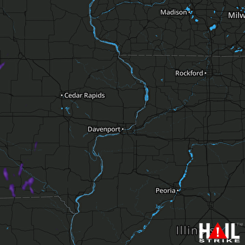 DAVENPORT (KDVN) RADAR

