This weather event on July 22, 2025 includes:
2 states
35 counties,
14 cities,
and 76 zip codes.
There were 319 total properties that were impacted and have possible damage.
States Impacted By Hail On July 22, 2025
New Mexico
·
Texas
Counties Impacted By Hail On July 22, 2025
Chaves, NM
·
Eddy, NM
·
Lea, NM
·
Roosevelt, NM
·
Andrews, TX
·
Borden, TX
·
Brewster, TX
·
Cochran, TX
·
Crockett, TX
·
Crosby, TX
·
Culberson, TX
·
Dawson, TX
·
Garza, TX
·
Glasscock, TX
·
Hale, TX
·
Hockley, TX
·
Howard, TX
·
Jeff Davis, TX
·
Lamb, TX
·
Loving, TX
·
Lubbock, TX
·
Lynn, TX
·
Martin, TX
·
Midland, TX
·
Pecos, TX
·
Reagan, TX
·
Reeves, TX
·
Scurry, TX
·
Sterling, TX
·
Terrell, TX
·
Terry, TX
·
Upton, TX
·
Ward, TX
·
Winkler, TX
·
Yoakum, TX
Cities Impacted By Hail On July 22, 2025
Anton, TX
·
Causey, NM
·
Fort Stockton, TX
·
Gail, TX
·
Grandfalls, TX
·
Lamesa, TX
·
Levelland, TX
·
Los Ybanez, TX
·
Marathon, TX
·
Midland, TX
·
Monahans, TX
·
Morton, TX
·
Ralls, TX
·
Whiteface, TX
Zip Codes Impacted By Hail On July 22, 2025
76943
·
76951
·
78851
·
79021
·
79041
·
79064
·
79313
·
79314
·
79322
·
79326
·
79330
·
79331
·
79336
·
79339
·
79343
·
79345
·
79346
·
79351
·
79356
·
79357
·
79358
·
79363
·
79367
·
79369
·
79370
·
79379
·
79382
·
79407
·
79517
·
79549
·
79706
·
79707
·
79713
·
79718
·
79720
·
79730
·
79734
·
79735
·
79738
·
79739
·
79742
·
79744
·
79745
·
79749
·
79752
·
79754
·
79756
·
79770
·
79772
·
79777
·
79781
·
79782
·
79783
·
79789
·
79830
·
79831
·
79842
·
79848
·
79855
·
88113
·
88114
·
88125
·
88132
·
88201
·
88220
·
88231
·
88240
·
88252
·
88256
·
88260
·
88263
·
88267
·
76932
·
79355
·
79373
·
88116
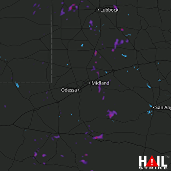 MIDLAND/ODSSA (KMAF) RADAR

