This weather event on July 21, 2025 includes:
3 states
29 counties,
19 cities,
and 87 zip codes.
There were 39 total properties that were impacted and have possible damage.
States Impacted By Hail On July 21, 2025
Minnesota
·
North Dakota
·
South Dakota
Counties Impacted By Hail On July 21, 2025
Clay, MN
·
Grant, MN
·
Norman, MN
·
Otter Tail, MN
·
Traverse, MN
·
Wilkin, MN
·
Burleigh, ND
·
Cass, ND
·
Emmons, ND
·
Grant, ND
·
Logan, ND
·
Morton, ND
·
Richland, ND
·
Sioux, ND
·
Stutsman, ND
·
Traill, ND
·
Brown, SD
·
Campbell, SD
·
Corson, SD
·
Day, SD
·
Dewey, SD
·
Edmunds, SD
·
Faulk, SD
·
Haakon, SD
·
Hand, SD
·
Potter, SD
·
Spink, SD
·
Stanley, SD
·
Walworth, SD
Cities Impacted By Hail On July 21, 2025
Cannon Ball, ND
·
Dalton, MN
·
Fargo, ND
·
Grandin, ND
·
Green Grass, SD
·
La Plant, SD
·
Little Eagle, SD
·
Mansfield, SD
·
Moorhead, MN
·
Nashua, MN
·
North Eagle Butte, SD
·
North River, ND
·
Onaka, SD
·
Perley, MN
·
Pierpont, SD
·
Timber Lake, SD
·
Tintah, MN
·
Warner, SD
·
Whitehorse, SD
Zip Codes Impacted By Hail On July 21, 2025
56274
·
56296
·
56324
·
56519
·
56533
·
56534
·
56536
·
56537
·
56550
·
56560
·
56565
·
56572
·
56574
·
56579
·
56583
·
57261
·
57373
·
57381
·
57401
·
57420
·
57422
·
57424
·
57427
·
57428
·
57429
·
57433
·
57434
·
57435
·
57438
·
57442
·
57445
·
57450
·
57451
·
57460
·
57461
·
57465
·
57466
·
57468
·
57470
·
57471
·
57474
·
57475
·
57477
·
57479
·
57537
·
57552
·
57601
·
57625
·
57630
·
57631
·
57633
·
57642
·
57646
·
57652
·
57656
·
57657
·
57658
·
57661
·
58008
·
58018
·
58030
·
58036
·
58038
·
58047
·
58061
·
58075
·
58077
·
58455
·
58476
·
58503
·
58504
·
58528
·
58538
·
58549
·
58552
·
58554
·
58558
·
58561
·
58566
·
58568
·
58569
·
58570
·
56547
·
56590
·
57639
·
58021
·
58102
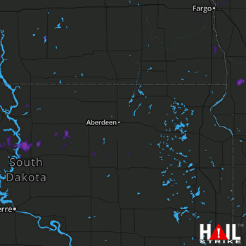 ABERDEEN (KABR) RADAR

