This weather event on July 21, 2025 includes:
3 states
25 counties,
16 cities,
and 67 zip codes.
There were 125 total properties that were impacted and have possible damage.
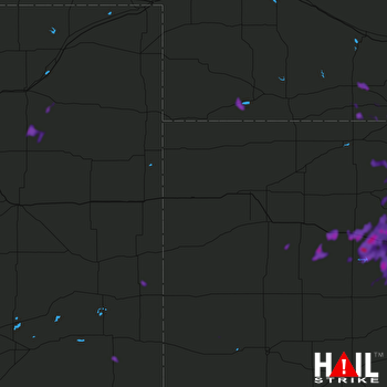 GOODLAND (KGLD) RADAR
States Impacted By Hail On July 21, 2025
Colorado
·
Kansas
·
Nebraska
Counties Impacted By Hail On July 21, 2025
Cheyenne, CO
·
Elbert, CO
·
El Paso, CO
·
Kiowa, CO
·
Morgan, CO
·
Prowers, CO
·
Washington, CO
·
Ellis, KS
·
Gove, KS
·
Graham, KS
·
Kearny, KS
·
Ness, KS
·
Norton, KS
·
Osborne, KS
·
Phillips, KS
·
Rooks, KS
·
Rush, KS
·
Russell, KS
·
Smith, KS
·
Trego, KS
·
Wichita, KS
·
Furnas, NE
·
Gosper, NE
·
Harlan, NE
·
Hitchcock, NE
Cities Impacted By Hail On July 21, 2025
Beaver City, NE
·
Catharine, KS
·
Collyer, KS
·
Edison, NE
·
Ellis, KS
·
Kensington, KS
·
Liebenthal, KS
·
Logan, KS
·
Natoma, KS
·
Phillipsburg, KS
·
Plainville, KS
·
Stamford, NE
·
Stratton, NE
·
WaKeeney, KS
·
Woodston, KS
·
Zurich, KS
Zip Codes Impacted By Hail On July 21, 2025
66951
·
67520
·
67521
·
67548
·
67553
·
67556
·
67572
·
67601
·
67621
·
67622
·
67623
·
67628
·
67631
·
67632
·
67637
·
67639
·
67640
·
67644
·
67645
·
67646
·
67647
·
67651
·
67656
·
67657
·
67658
·
67660
·
67661
·
67663
·
67665
·
67669
·
67671
·
67672
·
67674
·
67675
·
67736
·
67738
·
67748
·
67752
·
67857
·
67860
·
67861
·
68920
·
68922
·
68926
·
68936
·
68966
·
68967
·
68977
·
69040
·
69043
·
69044
·
80101
·
80117
·
80720
·
80723
·
80740
·
80757
·
80802
·
80808
·
80830
·
80832
·
80833
·
80835
·
81041
·
81052
·
81071
·
67584

