This weather event on July 21, 2025 includes:
2 states
20 counties,
13 cities,
and 60 zip codes.
There were 2426 total properties that were impacted and have possible damage.
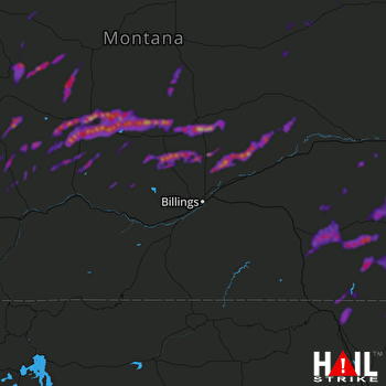 BILLINGS (KBLX) RADAR
States Impacted By Hail On July 21, 2025
Montana
·
Wyoming
Counties Impacted By Hail On July 21, 2025
Big Horn, MT
·
Carbon, MT
·
Cascade, MT
·
Custer, MT
·
Fergus, MT
·
Gallatin, MT
·
Garfield, MT
·
Golden Valley, MT
·
Judith Basin, MT
·
Meagher, MT
·
Musselshell, MT
·
Park, MT
·
Powder River, MT
·
Rosebud, MT
·
Stillwater, MT
·
Sweet Grass, MT
·
Treasure, MT
·
Wheatland, MT
·
Yellowstone, MT
·
Sheridan, WY
Cities Impacted By Hail On July 21, 2025
Ashland, MT
·
Broadview, MT
·
Busby, MT
·
Camp Three, MT
·
Geyser, MT
·
Harlowton, MT
·
Klein, MT
·
Lame Deer, MT
·
Muddy, MT
·
Ryegate, MT
·
Shawmut, MT
·
Sheridan, WY
·
Wilsall, MT
Zip Codes Impacted By Hail On July 21, 2025
59003
·
59011
·
59012
·
59015
·
59016
·
59018
·
59022
·
59024
·
59025
·
59032
·
59034
·
59036
·
59038
·
59043
·
59047
·
59050
·
59052
·
59053
·
59054
·
59055
·
59057
·
59058
·
59059
·
59067
·
59068
·
59069
·
59072
·
59074
·
59077
·
59078
·
59085
·
59086
·
59088
·
59301
·
59312
·
59317
·
59318
·
59323
·
59327
·
59333
·
59337
·
59347
·
59351
·
59418
·
59441
·
59447
·
59452
·
59453
·
59463
·
59465
·
59479
·
59642
·
59645
·
59715
·
82801
·
82835
·
82839
·
59046
·
59062
·
59079

