This weather event on July 20, 2025 includes:
2 states
16 counties,
18 cities,
and 50 zip codes.
There were total properties that were impacted and have possible damage.
States Impacted By Hail On July 20, 2025
Iowa
·
South Dakota
Counties Impacted By Hail On July 20, 2025
Adair, IA
·
Buena Vista, IA
·
Calhoun, IA
·
Cass, IA
·
Dallas, IA
·
Guthrie, IA
·
Ida, IA
·
Madison, IA
·
Pocahontas, IA
·
Polk, IA
·
Warren, IA
·
Woodbury, IA
·
Hutchinson, SD
·
Lincoln, SD
·
Turner, SD
·
Yankton, SD
Cities Impacted By Hail On July 20, 2025
Atlantic, IA
·
Clive, IA
·
Cumming, IA
·
Des Moines, IA
·
Fontanelle, IA
·
Greenfield, IA
·
Grimes, IA
·
Indianola, IA
·
Johnston, IA
·
Norwalk, IA
·
Redfield, IA
·
Spring Hill, IA
·
Truesdale, IA
·
Urbandale, IA
·
Viborg, SD
·
Waukee, IA
·
West Des Moines, IA
·
Windsor Heights, IA
Zip Codes Impacted By Hail On July 20, 2025
50003
·
50022
·
50061
·
50070
·
50111
·
50125
·
50131
·
50164
·
50211
·
50216
·
50229
·
50250
·
50263
·
50265
·
50266
·
50309
·
50310
·
50311
·
50312
·
50313
·
50314
·
50315
·
50320
·
50321
·
50322
·
50323
·
50324
·
50325
·
50540
·
50551
·
50568
·
50576
·
50579
·
50588
·
50846
·
50849
·
50853
·
51002
·
51006
·
51445
·
51453
·
57004
·
57014
·
57021
·
57029
·
57036
·
57045
·
57070
·
50233
·
50072
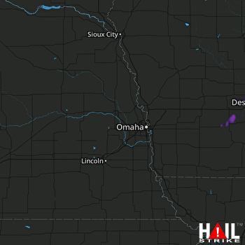 OMAHA (KOAX) RADAR

