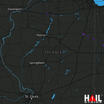
This weather event on July 20, 2025 includes:
2 states
21 counties,
16 cities,
and 49 zip codes.
There were 284 total properties that were impacted and have possible damage.
States Impacted By Hail On July 20, 2025
Illinois
·
Indiana
Counties Impacted By Hail On July 20, 2025
Bureau, IL
·
Champaign, IL
·
Ford, IL
·
Grundy, IL
·
Iroquois, IL
·
Kankakee, IL
·
Lee, IL
·
Logan, IL
·
Macon, IL
·
Mason, IL
·
McLean, IL
·
Menard, IL
·
Vermilion, IL
·
Will, IL
·
Benton, IN
·
Fountain, IN
·
Jasper, IN
·
Montgomery, IN
·
Newton, IN
·
Tippecanoe, IN
·
Warren, IN
Cities Impacted By Hail On July 20, 2025
Bloomington, IL
·
Braceville, IL
·
Braidwood, IL
·
Gilman, IL
·
Godley, IL
·
Lafayette, IN
·
Lincoln, IL
·
Linden, IN
·
Montmorenci, IN
·
New Richmond, IN
·
Onarga, IL
·
Otterbein, IN
·
Oxford, IN
·
Princeton, IL
·
West Lafayette, IN
·
West Point, IN
Zip Codes Impacted By Hail On July 20, 2025
46349
·
47901
·
47904
·
47906
·
47907
·
47909
·
47917
·
47918
·
47933
·
47940
·
47943
·
47955
·
47967
·
47970
·
47971
·
47975
·
47978
·
47981
·
47992
·
60407
·
60416
·
60924
·
60928
·
60938
·
60942
·
60953
·
60955
·
60958
·
60973
·
61021
·
61081
·
61356
·
61379
·
61704
·
61705
·
61756
·
61773
·
61862
·
62512
·
62548
·
62613
·
62633
·
62634
·
62642
·
62655
·
62656
·
62666
·
62675
·
60408
 LINCOLN (KILX) RADAR

