This weather event on July 20, 2025 includes:
3 states
21 counties,
20 cities,
and 74 zip codes.
There were total properties that were impacted and have possible damage.
States Impacted By Hail On July 20, 2025
Iowa
·
Kansas
·
Missouri
Counties Impacted By Hail On July 20, 2025
Appanoose, IA
·
Decatur, IA
·
Ringgold, IA
·
Wayne, IA
·
Atchison, KS
·
Jackson, KS
·
Jefferson, KS
·
Marshall, KS
·
Nemaha, KS
·
Pottawatomie, KS
·
Shawnee, KS
·
Adair, MO
·
Buchanan, MO
·
Daviess, MO
·
Grundy, MO
·
Harrison, MO
·
Mercer, MO
·
Platte, MO
·
Putnam, MO
·
Sullivan, MO
·
Worth, MO
Cities Impacted By Hail On July 20, 2025
Atchison, KS
·
Cincinnati, IA
·
Corydon, IA
·
Denver, MO
·
Eagleville, MO
·
Goff, KS
·
Green City, MO
·
Kirksville, MO
·
Lamoni, IA
·
Leon, IA
·
Lewis and Clark Village, MO
·
Lineville, IA
·
Lucerne, MO
·
Milan, MO
·
Novinger, MO
·
Powersville, MO
·
Seymour, IA
·
St. Joseph, MO
·
Unionville, MO
·
Vermillion, KS
Zip Codes Impacted By Hail On July 20, 2025
50008
·
50052
·
50060
·
50065
·
50067
·
50103
·
50123
·
50140
·
50147
·
50854
·
52544
·
52549
·
52555
·
52583
·
52590
·
63501
·
63533
·
63544
·
63545
·
63546
·
63551
·
63556
·
63559
·
63560
·
63565
·
64424
·
64440
·
64441
·
64442
·
64456
·
64481
·
64484
·
64504
·
64640
·
64641
·
64642
·
64645
·
64648
·
64655
·
64661
·
64667
·
64672
·
64673
·
64679
·
66002
·
66016
·
66023
·
66041
·
66058
·
66060
·
66070
·
66088
·
66097
·
66416
·
66417
·
66419
·
66424
·
66428
·
66429
·
66432
·
66436
·
66440
·
66512
·
66521
·
66539
·
66540
·
66544
·
66549
·
66550
·
66617
·
66618
·
66073
·
64683
·
50144
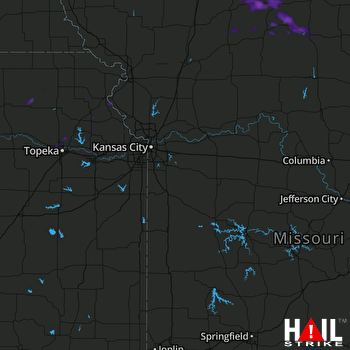 KANSAS CITY (KEAX) RADAR

