This weather event on July 19, 2025 includes:
3 states
19 counties,
14 cities,
and 62 zip codes.
There were 59 total properties that were impacted and have possible damage.
States Impacted By Hail On July 19, 2025
Kansas
·
Missouri
·
Nebraska
Counties Impacted By Hail On July 19, 2025
Atchison, KS
·
Cloud, KS
·
Jackson, KS
·
Jefferson, KS
·
Jewell, KS
·
Marshall, KS
·
Mitchell, KS
·
Nemaha, KS
·
Osborne, KS
·
Pottawatomie, KS
·
Republic, KS
·
Shawnee, KS
·
Smith, KS
·
Daviess, MO
·
Clay, NE
·
Fillmore, NE
·
Gage, NE
·
Nuckolls, NE
·
Webster, NE
Cities Impacted By Hail On July 19, 2025
Cawker City, KS
·
Cowles, NE
·
Deweese, NE
·
Esbon, KS
·
Fairfield, NE
·
Glen Elder, KS
·
Jewell, KS
·
Lawrence, NE
·
Lebanon, KS
·
Mankato, KS
·
Osborne, KS
·
Portis, KS
·
Red Cloud, NE
·
Silver Lake, KS
Zip Codes Impacted By Hail On July 19, 2025
64640
·
64670
·
66016
·
66060
·
66070
·
66088
·
66406
·
66412
·
66416
·
66417
·
66418
·
66427
·
66428
·
66432
·
66508
·
66509
·
66512
·
66533
·
66539
·
66540
·
66550
·
66615
·
66617
·
66618
·
66930
·
66936
·
66939
·
66941
·
66942
·
66948
·
66949
·
66952
·
66956
·
66963
·
66964
·
66966
·
66967
·
67420
·
67430
·
67437
·
67446
·
67473
·
67474
·
67623
·
67638
·
67651
·
67658
·
67673
·
68466
·
68930
·
68933
·
68934
·
68935
·
68938
·
68941
·
68942
·
68943
·
68944
·
68952
·
68957
·
68970
·
68979
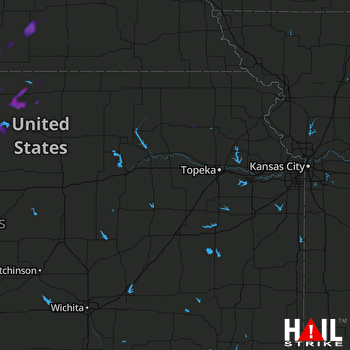 TOPEKA (KTWX) RADAR

