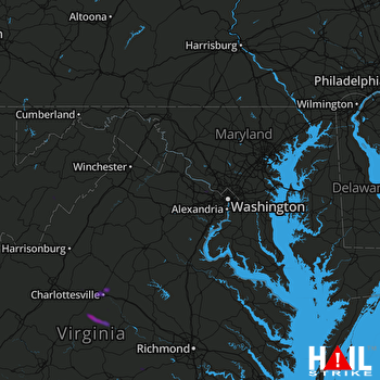
This weather event on July 19, 2025 includes:
5 states
20 counties,
20 cities,
and 51 zip codes.
There were 2745 total properties that were impacted and have possible damage.
States Impacted By Hail On July 19, 2025
District of Columbia
·
Delaware
·
Maryland
·
Virginia
·
West Virginia
Counties Impacted By Hail On July 19, 2025
District of Columbia, DC
·
Sussex, DE
·
Montgomery, MD
·
Worcester, MD
·
Albemarle, VA
·
Amelia, VA
·
Arlington, VA
·
Buckingham, VA
·
Charlottesville, VA
·
Clarke, VA
·
Dinwiddie, VA
·
Fairfax, VA
·
Fluvanna, VA
·
Henrico, VA
·
Loudoun, VA
·
Nottoway, VA
·
Prince Edward, VA
·
Rockingham, VA
·
Grant, WV
·
Hardy, WV
Cities Impacted By Hail On July 19, 2025
Arlington, VA
·
Bethesda, MD
·
Broadlands, VA
·
Brookmont, MD
·
Charlottesville, VA
·
Crozet, VA
·
East Highland Park, VA
·
Esmont, VA
·
Great Falls, VA
·
Highland Springs, VA
·
Hollymead, VA
·
Ivy, VA
·
Leesburg, VA
·
McLean, VA
·
Newark, MD
·
Reston, VA
·
Scottsville, VA
·
Travilah, MD
·
University of Virginia, VA
·
Wolf Trap, VA
Zip Codes Impacted By Hail On July 19, 2025
19947
·
19956
·
20016
·
20105
·
20117
·
20130
·
20141
·
20147
·
20148
·
20175
·
20184
·
20190
·
20191
·
20194
·
20816
·
20854
·
21811
·
21841
·
22066
·
22101
·
22182
·
22207
·
22827
·
22901
·
22902
·
22903
·
22904
·
22911
·
22923
·
22931
·
22932
·
22936
·
22937
·
22938
·
22946
·
22963
·
22969
·
23002
·
23075
·
23083
·
23084
·
23223
·
23833
·
23885
·
23922
·
23930
·
23942
·
24590
·
26818
·
26836
·
26847
 STERLING (KLWX) RADAR

