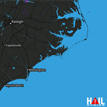
This weather event on July 19, 2025 includes:
2 states
24 counties,
12 cities,
and 62 zip codes.
There were total properties that were impacted and have possible damage.
States Impacted By Hail On July 19, 2025
North Carolina
·
Virginia
Counties Impacted By Hail On July 19, 2025
Beaufort, NC
·
Bertie, NC
·
Chatham, NC
·
Cumberland, NC
·
Dare, NC
·
Edgecombe, NC
·
Franklin, NC
·
Gates, NC
·
Granville, NC
·
Halifax, NC
·
Hertford, NC
·
Hyde, NC
·
Johnston, NC
·
Nash, NC
·
Northampton, NC
·
Orange, NC
·
Perquimans, NC
·
Pitt, NC
·
Tyrrell, NC
·
Vance, NC
·
Wake, NC
·
Warren, NC
·
Wilson, NC
·
Brunswick, VA
Cities Impacted By Hail On July 19, 2025
Butner, NC
·
Creedmoor, NC
·
Ebony, VA
·
Engelhard, NC
·
Fairfield, NC
·
Gasburg, VA
·
Kill Devil Hills, NC
·
Kitty Hawk, NC
·
Linden, NC
·
Rocky Mount, NC
·
Wilson, NC
·
Winton, NC
Zip Codes Impacted By Hail On July 19, 2025
23845
·
23857
·
23868
·
23887
·
23893
·
23919
·
23920
·
27508
·
27509
·
27517
·
27522
·
27525
·
27537
·
27542
·
27551
·
27553
·
27557
·
27563
·
27576
·
27581
·
27587
·
27596
·
27597
·
27614
·
27801
·
27803
·
27805
·
27808
·
27810
·
27816
·
27823
·
27824
·
27826
·
27834
·
27842
·
27843
·
27847
·
27849
·
27850
·
27851
·
27855
·
27856
·
27869
·
27872
·
27874
·
27884
·
27885
·
27886
·
27891
·
27893
·
27897
·
27910
·
27925
·
27935
·
27944
·
27948
·
27949
·
27986
·
28356
·
27549
·
27589
·
27953
 MOREHEAD CITY (KMHX) RADAR

