This weather event on July 18, 2025 includes:
2 states
35 counties,
11 cities,
and 67 zip codes.
There were 139 total properties that were impacted and have possible damage.
States Impacted By Hail On July 18, 2025
Florida
·
Georgia
Counties Impacted By Hail On July 18, 2025
Baker, FL
·
Bradford, FL
·
Clay, FL
·
Columbia, FL
·
Duval, FL
·
Hamilton, FL
·
Madison, FL
·
Nassau, FL
·
Bacon, GA
·
Baker, GA
·
Brantley, GA
·
Brooks, GA
·
Bulloch, GA
·
Calhoun, GA
·
Camden, GA
·
Candler, GA
·
Charlton, GA
·
Clinch, GA
·
Dooly, GA
·
Dougherty, GA
·
Echols, GA
·
Evans, GA
·
Lee, GA
·
Liberty, GA
·
Long, GA
·
Lowndes, GA
·
Miller, GA
·
Pierce, GA
·
Stewart, GA
·
Sumter, GA
·
Tattnall, GA
·
Terrell, GA
·
Toombs, GA
·
Ware, GA
·
Wayne, GA
Cities Impacted By Hail On July 18, 2025
Callahan, FL
·
Colquitt, GA
·
Echols County, GA
·
Jacksonville, FL
·
Jennings, FL
·
Kingsland, GA
·
Lumpkin, GA
·
Nassau Village-Ratliff, FL
·
Oakleaf Plantation, FL
·
Sasser, GA
·
Statesboro, GA
Zip Codes Impacted By Hail On July 18, 2025
30415
·
30417
·
30421
·
30436
·
30439
·
30452
·
30458
·
30461
·
31007
·
31092
·
31313
·
31316
·
31321
·
31503
·
31510
·
31537
·
31543
·
31546
·
31548
·
31554
·
31565
·
31568
·
31569
·
31629
·
31631
·
31636
·
31638
·
31643
·
31721
·
31763
·
31764
·
31787
·
31815
·
32011
·
32025
·
32040
·
32044
·
32046
·
32053
·
32055
·
32065
·
32072
·
32087
·
32091
·
32097
·
32205
·
32208
·
32209
·
32218
·
32219
·
32220
·
32226
·
32254
·
32277
·
32340
·
32350
·
32622
·
39826
·
39842
·
39845
·
39862
·
39870
·
39885
·
39837
·
32222
·
31516
·
30453
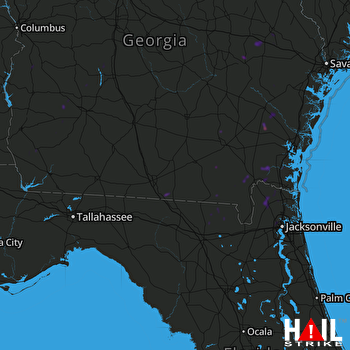 MOODY AFB (KVAX) RADAR

