This weather event on July 18, 2025 includes:
2 states
16 counties,
21 cities,
and 65 zip codes.
There were 1268 total properties that were impacted and have possible damage.
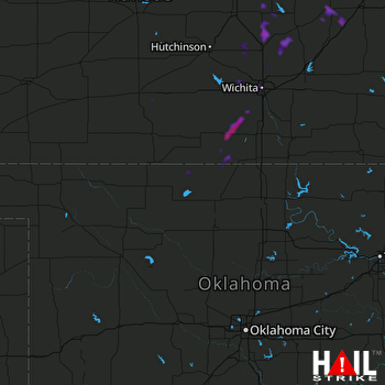 VANCE AFB (KVNX) RADAR
States Impacted By Hail On July 18, 2025
Kansas
·
Oklahoma
Counties Impacted By Hail On July 18, 2025
Butler, KS
·
Chase, KS
·
Dickinson, KS
·
Ellsworth, KS
·
Harper, KS
·
Harvey, KS
·
Lyon, KS
·
Marion, KS
·
McPherson, KS
·
Morris, KS
·
Pratt, KS
·
Saline, KS
·
Sedgwick, KS
·
Sumner, KS
·
Alfalfa, OK
·
Grant, OK
Cities Impacted By Hail On July 18, 2025
Andale, KS
·
Anthony, KS
·
Argonia, KS
·
Brookville, KS
·
Clearwater, KS
·
Colwich, KS
·
Conway Springs, KS
·
Cottonwood Falls, KS
·
Elbing, KS
·
El Dorado, KS
·
Goessel, KS
·
Gypsum, KS
·
Halstead, KS
·
Hillsboro, KS
·
Kechi, KS
·
Milan, KS
·
Newton, KS
·
Park City, KS
·
Strong City, KS
·
Valley Center, KS
·
Wichita, KS
Zip Codes Impacted By Hail On July 18, 2025
66801
·
66838
·
66845
·
66850
·
66861
·
66865
·
66866
·
66869
·
67001
·
67003
·
67004
·
67018
·
67020
·
67026
·
67030
·
67031
·
67035
·
67041
·
67042
·
67049
·
67053
·
67056
·
67060
·
67062
·
67063
·
67065
·
67073
·
67103
·
67105
·
67107
·
67114
·
67124
·
67135
·
67147
·
67151
·
67154
·
67202
·
67203
·
67204
·
67209
·
67211
·
67212
·
67213
·
67214
·
67215
·
67216
·
67217
·
67219
·
67227
·
67438
·
67443
·
67448
·
67449
·
67451
·
67460
·
67483
·
73722
·
73728
·
73758
·
73759
·
73719
·
67425
·
67022
·
66851
·
66840

