This weather event on July 17, 2025 includes:
3 states
33 counties,
7 cities,
and 74 zip codes.
There were 1167 total properties that were impacted and have possible damage.
States Impacted By Hail On July 17, 2025
New Mexico
·
Oklahoma
·
Texas
Counties Impacted By Hail On July 17, 2025
Curry, NM
·
De Baca, NM
·
Guadalupe, NM
·
Harding, NM
·
Quay, NM
·
Roosevelt, NM
·
San Miguel, NM
·
Union, NM
·
Cimarron, OK
·
Greer, OK
·
Harmon, OK
·
Texas, OK
·
Armstrong, TX
·
Carson, TX
·
Castro, TX
·
Childress, TX
·
Collingsworth, TX
·
Dallam, TX
·
Deaf Smith, TX
·
Donley, TX
·
Hale, TX
·
Hall, TX
·
Hansford, TX
·
Hartley, TX
·
Hutchinson, TX
·
Motley, TX
·
Oldham, TX
·
Parmer, TX
·
Potter, TX
·
Randall, TX
·
Roberts, TX
·
Sherman, TX
·
Swisher, TX
Cities Impacted By Hail On July 17, 2025
Amarillo, TX
·
Grady, NM
·
Logan, NM
·
Melrose, NM
·
Newkirk, NM
·
Stratford, TX
·
Tucumcari, NM
Zip Codes Impacted By Hail On July 17, 2025
73544
·
73547
·
73550
·
73554
·
73933
·
73939
·
73949
·
79001
·
79010
·
79012
·
79015
·
79018
·
79019
·
79022
·
79025
·
79032
·
79035
·
79040
·
79042
·
79045
·
79052
·
79065
·
79072
·
79078
·
79081
·
79083
·
79084
·
79088
·
79091
·
79092
·
79095
·
79098
·
79104
·
79107
·
79108
·
79109
·
79110
·
79118
·
79119
·
79201
·
79226
·
79230
·
79237
·
79239
·
79240
·
87730
·
87733
·
87743
·
87746
·
88101
·
88112
·
88116
·
88118
·
88119
·
88120
·
88124
·
88135
·
88401
·
88410
·
88411
·
88415
·
88416
·
88417
·
88422
·
88424
·
88426
·
88427
·
88430
·
88431
·
88434
·
88435
·
88436
·
79068
·
79027
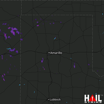 AMARILLO (KAMA) RADAR

