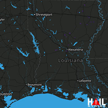
This weather event on July 17, 2025 includes:
3 states
22 counties,
14 cities,
and 61 zip codes.
There were 983 total properties that were impacted and have possible damage.
States Impacted By Hail On July 17, 2025
Arkansas
·
Louisiana
·
Mississippi
Counties Impacted By Hail On July 17, 2025
Union, AR
·
Acadia, LA
·
Allen, LA
·
Avoyelles, LA
·
Caldwell, LA
·
Catahoula, LA
·
Concordia, LA
·
Franklin, LA
·
Grant, LA
·
LaSalle, LA
·
Madison, LA
·
Morehouse, LA
·
Natchitoches, LA
·
Ouachita, LA
·
Rapides, LA
·
Richland, LA
·
Tensas, LA
·
Vernon, LA
·
Winn, LA
·
Adams, MS
·
Amite, MS
·
Wilkinson, MS
Cities Impacted By Hail On July 17, 2025
Alexandria, LA
·
Ball, LA
·
Dry Prong, LA
·
Jena, LA
·
Jordan Hill, LA
·
Liberty, MS
·
Monroe, LA
·
Oak Ridge, LA
·
Pineville, LA
·
Pollock, LA
·
Prospect, LA
·
Strong, AR
·
Swartz, LA
·
Urania, LA
Zip Codes Impacted By Hail On July 17, 2025
39120
·
39633
·
39645
·
39652
·
39669
·
70532
·
70535
·
70655
·
70656
·
71202
·
71203
·
71219
·
71220
·
71229
·
71232
·
71259
·
71261
·
71264
·
71269
·
71282
·
71295
·
71301
·
71302
·
71303
·
71328
·
71331
·
71334
·
71336
·
71340
·
71342
·
71343
·
71351
·
71354
·
71355
·
71357
·
71360
·
71373
·
71378
·
71401
·
71405
·
71409
·
71418
·
71422
·
71423
·
71427
·
71432
·
71435
·
71446
·
71447
·
71455
·
71465
·
71467
·
71468
·
71473
·
71479
·
71480
·
71483
·
71747
·
71765
·
71292
·
71223
 FORT POLK (KPOE) RADAR

