This weather event on July 16, 2025 includes:
2 states
35 counties,
13 cities,
and 76 zip codes.
There were total properties that were impacted and have possible damage.
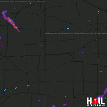 GOODLAND (KGLD) RADAR
States Impacted By Hail On July 16, 2025
Colorado
·
Kansas
Counties Impacted By Hail On July 16, 2025
Adams, CO
·
Arapahoe, CO
·
Crowley, CO
·
Elbert, CO
·
El Paso, CO
·
Lincoln, CO
·
Logan, CO
·
Morgan, CO
·
Otero, CO
·
Prowers, CO
·
Washington, CO
·
Weld, CO
·
Edwards, KS
·
Ford, KS
·
Graham, KS
·
Grant, KS
·
Gray, KS
·
Greeley, KS
·
Hamilton, KS
·
Haskell, KS
·
Hodgeman, KS
·
Kearny, KS
·
Logan, KS
·
Ness, KS
·
Pawnee, KS
·
Phillips, KS
·
Rush, KS
·
Scott, KS
·
Seward, KS
·
Sheridan, KS
·
Smith, KS
·
Stanton, KS
·
Stevens, KS
·
Trego, KS
·
Wichita, KS
Cities Impacted By Hail On July 16, 2025
Agra, KS
·
Akron, CO
·
Burdett, KS
·
Byers, CO
·
Comanche Creek, CO
·
Dodge City, KS
·
Ensign, KS
·
Greeley County unified government (balance), KS
·
Jetmore, KS
·
Peoria, CO
·
Phillipsburg, KS
·
Rocky Ford, CO
·
Strasburg, CO
Zip Codes Impacted By Hail On July 16, 2025
66951
·
67513
·
67516
·
67547
·
67559
·
67574
·
67575
·
67621
·
67635
·
67637
·
67642
·
67645
·
67650
·
67656
·
67657
·
67659
·
67661
·
67672
·
67737
·
67740
·
67748
·
67753
·
67757
·
67801
·
67835
·
67841
·
67849
·
67854
·
67855
·
67857
·
67860
·
67861
·
67862
·
67863
·
67867
·
67870
·
67871
·
67876
·
67877
·
67879
·
67880
·
67882
·
67951
·
67952
·
80103
·
80105
·
80106
·
80117
·
80136
·
80654
·
80701
·
80720
·
80733
·
80741
·
80742
·
80743
·
80750
·
80754
·
80808
·
80828
·
80830
·
80831
·
80832
·
80833
·
80835
·
80864
·
81041
·
81047
·
81050
·
81052
·
81058
·
81063
·
81067
·
81076
·
67523
·
67878

