This weather event on July 16, 2025 includes:
5 states
39 counties,
9 cities,
and 88 zip codes.
There were total properties that were impacted and have possible damage.
States Impacted By Hail On July 16, 2025
Illinois
·
Indiana
·
Kentucky
·
Ohio
·
Tennessee
Counties Impacted By Hail On July 16, 2025
Clark, IL
·
Clay, IL
·
Crawford, IL
·
Edwards, IL
·
Hamilton, IL
·
Jasper, IL
·
Lawrence, IL
·
Richland, IL
·
Wabash, IL
·
Wayne, IL
·
White, IL
·
Clay, IN
·
Daviess, IN
·
Harrison, IN
·
Hendricks, IN
·
Knox, IN
·
Monroe, IN
·
Montgomery, IN
·
Morgan, IN
·
Owen, IN
·
Parke, IN
·
Pike, IN
·
Putnam, IN
·
Vigo, IN
·
Anderson, KY
·
Fleming, KY
·
Hardin, KY
·
Lewis, KY
·
Marion, KY
·
Mason, KY
·
Nicholas, KY
·
Pendleton, KY
·
Robertson, KY
·
Woodford, KY
·
Adams, OH
·
Cumberland, TN
·
Fentress, TN
·
Morgan, TN
·
Scott, TN
Cities Impacted By Hail On July 16, 2025
Bloomington, IN
·
Clay City, IL
·
Coatesville, IN
·
Elizaville, KY
·
Flora, IL
·
Heritage Lake, IN
·
Hidalgo, IL
·
Terre Haute, IN
·
Waveland, IN
Zip Codes Impacted By Hail On July 16, 2025
37726
·
37755
·
37770
·
37841
·
37852
·
38504
·
38571
·
40037
·
40311
·
40342
·
40383
·
41004
·
41039
·
41040
·
41041
·
41043
·
41055
·
41056
·
41064
·
41179
·
42732
·
45144
·
45684
·
46118
·
46121
·
46128
·
46180
·
47115
·
47166
·
47403
·
47404
·
47433
·
47438
·
47501
·
47557
·
47598
·
47802
·
47803
·
47841
·
47858
·
47872
·
47885
·
47933
·
47968
·
47989
·
62413
·
62419
·
62420
·
62421
·
62425
·
62427
·
62432
·
62441
·
62442
·
62446
·
62448
·
62449
·
62450
·
62454
·
62466
·
62475
·
62476
·
62477
·
62478
·
62479
·
62480
·
62481
·
62820
·
62821
·
62823
·
62824
·
62828
·
62833
·
62837
·
62839
·
62842
·
62843
·
62844
·
62858
·
62859
·
62862
·
62863
·
62868
·
62878
·
62887
·
62895
·
47866
·
47460
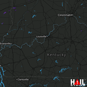 LOUISVILLE (KLVX) RADAR

