This weather event on July 15, 2025 includes:
2 states
23 counties,
16 cities,
and 56 zip codes.
There were 188 total properties that were impacted and have possible damage.
States Impacted By Hail On July 15, 2025
Oklahoma
·
Texas
Counties Impacted By Hail On July 15, 2025
Carter, OK
·
Cotton, OK
·
Garvin, OK
·
Love, OK
·
Murray, OK
·
Stephens, OK
·
Archer, TX
·
Bosque, TX
·
Clay, TX
·
Cooke, TX
·
Denton, TX
·
Hamilton, TX
·
Hill, TX
·
Jack, TX
·
Johnson, TX
·
Leon, TX
·
Montague, TX
·
Parker, TX
·
Somervell, TX
·
Stephens, TX
·
Tarrant, TX
·
Wise, TX
·
Young, TX
Cities Impacted By Hail On July 15, 2025
Ardmore, OK
·
Benbrook, TX
·
Burneyville, OK
·
Byers, TX
·
Cleburne, TX
·
Davis, OK
·
Decatur, TX
·
Foster, OK
·
Hamilton, TX
·
Lone Grove, OK
·
Marietta, OK
·
Newcastle, TX
·
Ratliff City, OK
·
Springer, OK
·
Sunset, TX
·
Tatums, OK
Zip Codes Impacted By Hail On July 15, 2025
73030
·
73086
·
73401
·
73425
·
73430
·
73433
·
73434
·
73438
·
73443
·
73444
·
73448
·
73453
·
73458
·
73463
·
73481
·
73487
·
73533
·
73548
·
73568
·
75833
·
76033
·
76035
·
76036
·
76044
·
76058
·
76126
·
76225
·
76230
·
76234
·
76238
·
76239
·
76240
·
76252
·
76263
·
76265
·
76266
·
76270
·
76272
·
76351
·
76357
·
76372
·
76374
·
76377
·
76389
·
76424
·
76431
·
76450
·
76481
·
76525
·
76531
·
76627
·
76652
·
76690
·
73491
·
76070
·
76251
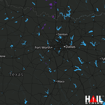 DALLAS/FTW (KFWS) RADAR

