This weather event on July 15, 2025 includes:
5 states
31 counties,
18 cities,
and 83 zip codes.
There were 108 total properties that were impacted and have possible damage.
States Impacted By Hail On July 15, 2025
Kentucky
·
North Carolina
·
Tennessee
·
Virginia
·
West Virginia
Counties Impacted By Hail On July 15, 2025
Floyd, KY
·
Letcher, KY
·
Alexander, NC
·
Catawba, NC
·
Forsyth, NC
·
Guilford, NC
·
Iredell, NC
·
Montgomery, NC
·
Moore, NC
·
Randolph, NC
·
Stokes, NC
·
Surry, NC
·
Wilkes, NC
·
Johnson, TN
·
Bedford, VA
·
Carroll, VA
·
Floyd, VA
·
Franklin, VA
·
Galax, VA
·
Grayson, VA
·
Henry, VA
·
Highland, VA
·
Patrick, VA
·
Pulaski, VA
·
Russell, VA
·
Scott, VA
·
Washington, VA
·
Wise, VA
·
Wythe, VA
·
Mercer, WV
·
Pocahontas, WV
Cities Impacted By Hail On July 15, 2025
Abingdon, VA
·
Ferrum, VA
·
Flat Rock, NC
·
Fort Chiswell, VA
·
Galax, VA
·
Germanton, NC
·
High Point, NC
·
Hiwassee, VA
·
Martin, KY
·
McDowell, KY
·
Mount Airy, NC
·
North Shore, VA
·
Oakvale, WV
·
Prestonsburg, KY
·
Statesville, NC
·
Toast, NC
·
Westlake Corner, VA
·
Wytheville, VA
Zip Codes Impacted By Hail On July 15, 2025
24055
·
24067
·
24076
·
24088
·
24091
·
24104
·
24120
·
24121
·
24133
·
24151
·
24184
·
24202
·
24210
·
24211
·
24225
·
24258
·
24260
·
24266
·
24293
·
24317
·
24324
·
24325
·
24328
·
24333
·
24343
·
24347
·
24351
·
24352
·
24361
·
24370
·
24380
·
24381
·
24382
·
24458
·
24465
·
24523
·
24740
·
24934
·
27019
·
27021
·
27022
·
27030
·
27052
·
27053
·
27205
·
27233
·
27242
·
27248
·
27265
·
27284
·
27298
·
27313
·
27317
·
27325
·
27341
·
27356
·
27371
·
28168
·
28327
·
28602
·
28625
·
28636
·
28670
·
28677
·
28678
·
37680
·
41601
·
41603
·
41615
·
41619
·
41630
·
41642
·
41645
·
41647
·
41649
·
41653
·
41655
·
41815
·
41855
·
24171
·
27235
·
27355
·
28669
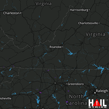 ROANOKE (KFCX) RADAR

