This weather event on July 15, 2025 includes:
3 states
31 counties,
12 cities,
and 64 zip codes.
There were 95 total properties that were impacted and have possible damage.
States Impacted By Hail On July 15, 2025
Alabama
·
Florida
·
Georgia
Counties Impacted By Hail On July 15, 2025
Henry, AL
·
Houston, AL
·
Alachua, FL
·
Calhoun, FL
·
Columbia, FL
·
Dixie, FL
·
Franklin, FL
·
Gulf, FL
·
Jackson, FL
·
Lafayette, FL
·
Leon, FL
·
Levy, FL
·
Liberty, FL
·
Suwannee, FL
·
Taylor, FL
·
Wakulla, FL
·
Berrien, GA
·
Chattahoochee, GA
·
Clay, GA
·
Clinch, GA
·
Early, GA
·
Lanier, GA
·
Lowndes, GA
·
Marion, GA
·
Quitman, GA
·
Randolph, GA
·
Stewart, GA
·
Tattnall, GA
·
Taylor, GA
·
Toombs, GA
·
Worth, GA
Cities Impacted By Hail On July 15, 2025
Alachua, FL
·
Blountstown, FL
·
Coleman, GA
·
Columbia, AL
·
Cusseta-Chattahoochee County, GA
·
Dothan, AL
·
Fort Gaines, GA
·
Georgetown-Quitman County, GA
·
Lyons, GA
·
Reidsville, GA
·
Reynolds, GA
·
Sumatra, FL
Zip Codes Impacted By Hail On July 15, 2025
30436
·
30453
·
30474
·
31006
·
31076
·
31601
·
31630
·
31634
·
31635
·
31639
·
31649
·
31791
·
31803
·
31805
·
31815
·
31825
·
32038
·
32066
·
32071
·
32303
·
32312
·
32320
·
32322
·
32328
·
32346
·
32358
·
32359
·
32420
·
32421
·
32424
·
32430
·
32438
·
32442
·
32443
·
32445
·
32446
·
32448
·
32449
·
32460
·
32465
·
32615
·
32625
·
32626
·
32628
·
32639
·
32648
·
32680
·
32692
·
36301
·
36312
·
36319
·
36320
·
36343
·
36370
·
36373
·
36376
·
39823
·
39836
·
39840
·
39851
·
39854
·
39867
·
32423
·
32321
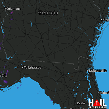 MOODY AFB (KVAX) RADAR

