This weather event on July 12, 2025 includes:
1 states
31 counties,
12 cities,
and 78 zip codes.
There were 222 total properties that were impacted and have possible damage.
States Impacted By Hail On July 12, 2025
Texas
Counties Impacted By Hail On July 12, 2025
Brown, TX
·
Callahan, TX
·
Coke, TX
·
Coleman, TX
·
Comanche, TX
·
Concho, TX
·
Coryell, TX
·
Fisher, TX
·
Glasscock, TX
·
Hamilton, TX
·
Haskell, TX
·
Howard, TX
·
Irion, TX
·
Jones, TX
·
King, TX
·
Lampasas, TX
·
McCulloch, TX
·
Menard, TX
·
Mills, TX
·
Mitchell, TX
·
Nolan, TX
·
Runnels, TX
·
San Saba, TX
·
Schleicher, TX
·
Scurry, TX
·
Shackelford, TX
·
Stephens, TX
·
Sterling, TX
·
Taylor, TX
·
Throckmorton, TX
·
Tom Green, TX
Cities Impacted By Hail On July 12, 2025
Abilene, TX
·
Brownwood, TX
·
Clyde, TX
·
Comanche, TX
·
Lueders, TX
·
Merkel, TX
·
Potosi, TX
·
Robert Lee, TX
·
Rotan, TX
·
San Angelo, TX
·
Stamford, TX
·
Tye, TX
Zip Codes Impacted By Hail On July 12, 2025
76429
·
76430
·
76432
·
76437
·
76442
·
76443
·
76446
·
76483
·
76525
·
76528
·
76531
·
76550
·
76801
·
76802
·
76821
·
76823
·
76825
·
76827
·
76828
·
76834
·
76837
·
76841
·
76844
·
76853
·
76857
·
76859
·
76862
·
76864
·
76866
·
76871
·
76872
·
76877
·
76890
·
76901
·
76903
·
76904
·
76905
·
76930
·
76933
·
76935
·
76936
·
76941
·
76945
·
76949
·
76951
·
76958
·
79236
·
79501
·
79503
·
79504
·
79506
·
79510
·
79512
·
79520
·
79521
·
79526
·
79533
·
79535
·
79536
·
79537
·
79543
·
79546
·
79553
·
79556
·
79563
·
79566
·
79601
·
79602
·
79603
·
79605
·
79606
·
79720
·
76424
·
76566
·
76832
·
79525
·
79561
·
79607
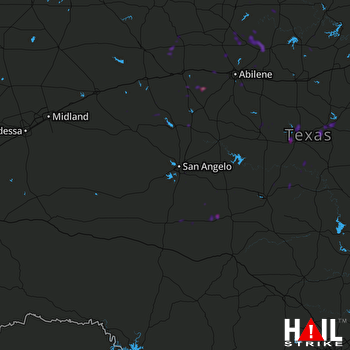 SAN ANGELO (KSJT) RADAR

