This weather event on July 11, 2025 includes:
2 states
19 counties,
13 cities,
and 89 zip codes.
There were 263 total properties that were impacted and have possible damage.
States Impacted By Hail On July 11, 2025
New York
·
Pennsylvania
Counties Impacted By Hail On July 11, 2025
Broome, NY
·
Chemung, NY
·
Chenango, NY
·
Cortland, NY
·
Greene, NY
·
Otsego, NY
·
Schuyler, NY
·
Steuben, NY
·
Tioga, NY
·
Tompkins, NY
·
Ulster, NY
·
Bradford, PA
·
Centre, PA
·
Clinton, PA
·
Lycoming, PA
·
Potter, PA
·
Snyder, PA
·
Tioga, PA
·
Union, PA
Cities Impacted By Hail On July 11, 2025
Arnot, PA
·
Elkland, PA
·
Gang Mills, NY
·
Loganton, PA
·
Mansfield, PA
·
Montour Falls, NY
·
Owego, NY
·
Penns Creek, PA
·
Rauchtown, PA
·
Southport, NY
·
West Hurley, NY
·
Woodstock, NY
·
Zena, NY
Zip Codes Impacted By Hail On July 11, 2025
12401
·
12404
·
12409
·
12416
·
12433
·
12450
·
12461
·
12464
·
12491
·
12492
·
12495
·
12498
·
12725
·
12740
·
13053
·
13068
·
13320
·
13326
·
13730
·
13743
·
13787
·
13803
·
13812
·
13833
·
13835
·
13864
·
14801
·
14810
·
14812
·
14817
·
14820
·
14823
·
14824
·
14830
·
14838
·
14839
·
14845
·
14855
·
14861
·
14865
·
14870
·
14871
·
14872
·
14879
·
14883
·
14889
·
14894
·
14898
·
14901
·
14904
·
16822
·
16872
·
16901
·
16911
·
16914
·
16917
·
16920
·
16922
·
16925
·
16929
·
16932
·
16933
·
16936
·
16938
·
16942
·
16946
·
16947
·
17702
·
17727
·
17729
·
17739
·
17740
·
17745
·
17747
·
17751
·
17779
·
17810
·
17837
·
17842
·
17844
·
17856
·
17862
·
18831
·
18840
·
18810
·
17776
·
14864
·
14819
·
13827
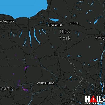 BINGHAMTON (KBGM) RADAR

