This weather event on July 11, 2025 includes:
3 states
20 counties,
20 cities,
and 60 zip codes.
There were 3193 total properties that were impacted and have possible damage.
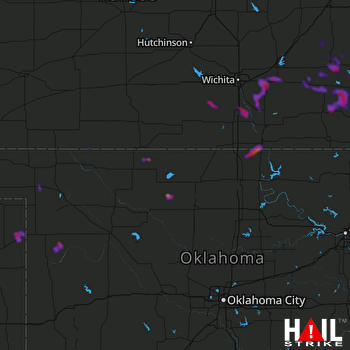 VANCE AFB (KVNX) RADAR
States Impacted By Hail On July 11, 2025
Kansas
·
Oklahoma
·
Texas
Counties Impacted By Hail On July 11, 2025
Barber, KS
·
Butler, KS
·
Comanche, KS
·
Cowley, KS
·
Elk, KS
·
Greenwood, KS
·
Meade, KS
·
Montgomery, KS
·
Sedgwick, KS
·
Sumner, KS
·
Wilson, KS
·
Woodson, KS
·
Alfalfa, OK
·
Beaver, OK
·
Ellis, OK
·
Harper, OK
·
Kay, OK
·
Major, OK
·
Woods, OK
·
Lipscomb, TX
Cities Impacted By Hail On July 11, 2025
Arkansas City, KS
·
Augusta, KS
·
Belle Plaine, KS
·
Burlington, OK
·
Climax, KS
·
Coyville, KS
·
Douglass, KS
·
Elk Falls, KS
·
Fairview, OK
·
Fall River, KS
·
Fredonia, KS
·
Goltry, OK
·
Helena, OK
·
Leon, KS
·
Longton, KS
·
New Albany, KS
·
Rose Hill, KS
·
Severy, KS
·
Viola, KS
·
Wichita, KS
Zip Codes Impacted By Hail On July 11, 2025
66710
·
66736
·
66757
·
66777
·
66852
·
66853
·
66860
·
66863
·
66870
·
67002
·
67010
·
67012
·
67013
·
67029
·
67031
·
67037
·
67039
·
67042
·
67045
·
67047
·
67051
·
67070
·
67074
·
67106
·
67110
·
67119
·
67120
·
67122
·
67131
·
67132
·
67133
·
67137
·
67146
·
67149
·
67152
·
67156
·
67344
·
67345
·
67349
·
67352
·
67869
·
73717
·
73718
·
73722
·
73737
·
73739
·
73760
·
73832
·
73840
·
73841
·
73848
·
73851
·
73938
·
74647
·
79046
·
79056
·
74632
·
73741
·
67005
·
66714

