This weather event on July 11, 2025 includes:
2 states
27 counties,
16 cities,
and 78 zip codes.
There were 1060 total properties that were impacted and have possible damage.
States Impacted By Hail On July 11, 2025
Kansas
·
Missouri
Counties Impacted By Hail On July 11, 2025
Allen, KS
·
Anderson, KS
·
Bourbon, KS
·
Coffey, KS
·
Crawford, KS
·
Elk, KS
·
Linn, KS
·
Miami, KS
·
Neosho, KS
·
Wilson, KS
·
Woodson, KS
·
Barton, MO
·
Bates, MO
·
Benton, MO
·
Cass, MO
·
Cedar, MO
·
Dade, MO
·
Greene, MO
·
Jackson, MO
·
Johnson, MO
·
Lafayette, MO
·
Lawrence, MO
·
Morgan, MO
·
Polk, MO
·
Ripley, MO
·
Vernon, MO
·
Webster, MO
Cities Impacted By Hail On July 11, 2025
Altoona, KS
·
Battlefield, MO
·
Blue Springs, MO
·
Grain Valley, MO
·
Greenwood, MO
·
Independence, MO
·
Lake Lotawana, MO
·
Lake Tapawingo, MO
·
Lee's Summit, MO
·
Neodesha, KS
·
Neosho Falls, KS
·
Oak Grove, MO
·
Osawatomie, KS
·
Republic, MO
·
Springfield, MO
·
Willard, MO
Zip Codes Impacted By Hail On July 11, 2025
63935
·
64014
·
64015
·
64020
·
64029
·
64034
·
64057
·
64063
·
64064
·
64070
·
64075
·
64080
·
64081
·
64082
·
64086
·
64701
·
64725
·
64728
·
64748
·
64752
·
64759
·
64762
·
64779
·
64784
·
65078
·
65084
·
65325
·
65604
·
65612
·
65617
·
65619
·
65646
·
65674
·
65682
·
65706
·
65710
·
65725
·
65742
·
65770
·
65781
·
65802
·
65803
·
65804
·
65806
·
65807
·
65809
·
65810
·
66014
·
66015
·
66026
·
66032
·
66039
·
66064
·
66071
·
66072
·
66075
·
66091
·
66093
·
66710
·
66714
·
66716
·
66720
·
66732
·
66733
·
66736
·
66743
·
66749
·
66755
·
66757
·
66758
·
66761
·
66772
·
66779
·
66783
·
66857
·
67047
·
66780
·
65738
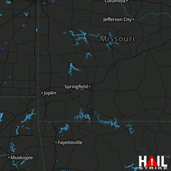 SPRINGFIELD (KSGF) RADAR

