This weather event on July 11, 2025 includes:
3 states
39 counties,
11 cities,
and 85 zip codes.
There were 217 total properties that were impacted and have possible damage.
States Impacted By Hail On July 11, 2025
Colorado
·
Kansas
·
Nebraska
Counties Impacted By Hail On July 11, 2025
Logan, CO
·
Phillips, CO
·
Sedgwick, CO
·
Decatur, KS
·
Rawlins, KS
·
Antelope, NE
·
Arthur, NE
·
Buffalo, NE
·
Chase, NE
·
Cherry, NE
·
Cheyenne, NE
·
Deuel, NE
·
Frontier, NE
·
Furnas, NE
·
Garden, NE
·
Gosper, NE
·
Grant, NE
·
Hall, NE
·
Harlan, NE
·
Hayes, NE
·
Hitchcock, NE
·
Hooker, NE
·
Howard, NE
·
Kearney, NE
·
Keith, NE
·
Knox, NE
·
Lincoln, NE
·
Logan, NE
·
Madison, NE
·
McPherson, NE
·
Merrick, NE
·
Morrill, NE
·
Nance, NE
·
Perkins, NE
·
Phelps, NE
·
Pierce, NE
·
Sherman, NE
·
Thomas, NE
·
Wheeler, NE
Cities Impacted By Hail On July 11, 2025
Axtell, NE
·
Chappell, NE
·
Creighton, NE
·
Elgin, NE
·
Enders, NE
·
Glenwood, NE
·
Hyannis, NE
·
Lorenzo, NE
·
Palisade, NE
·
Sedgwick, CO
·
Wauneta, NE
Zip Codes Impacted By Hail On July 11, 2025
67744
·
67749
·
68622
·
68636
·
68665
·
68726
·
68729
·
68735
·
68752
·
68756
·
68764
·
68767
·
68769
·
68773
·
68781
·
68820
·
68824
·
68845
·
68847
·
68852
·
68853
·
68858
·
68864
·
68869
·
68871
·
68873
·
68882
·
68922
·
68924
·
68926
·
68936
·
68937
·
68940
·
68948
·
68966
·
68967
·
69024
·
69027
·
69028
·
69029
·
69032
·
69033
·
69040
·
69046
·
69121
·
69122
·
69123
·
69125
·
69127
·
69129
·
69131
·
69140
·
69141
·
69144
·
69146
·
69147
·
69148
·
69149
·
69151
·
69152
·
69154
·
69155
·
69156
·
69162
·
69163
·
69165
·
69166
·
69167
·
69168
·
69301
·
69331
·
69333
·
69336
·
69350
·
69351
·
69366
·
80726
·
80731
·
80734
·
80737
·
80744
·
80749
·
69045
·
68982
·
67739
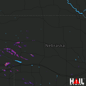 NORTH PLATTE (KLNX) RADAR

