This weather event on July 11, 2025 includes:
2 states
31 counties,
13 cities,
and 71 zip codes.
There were 261 total properties that were impacted and have possible damage.
States Impacted By Hail On July 11, 2025
Alabama
·
Mississippi
Counties Impacted By Hail On July 11, 2025
Sumter, AL
·
Amite, MS
·
Attala, MS
·
Bolivar, MS
·
Carroll, MS
·
Clarke, MS
·
Coahoma, MS
·
Covington, MS
·
Franklin, MS
·
Grenada, MS
·
Holmes, MS
·
Humphreys, MS
·
Jasper, MS
·
Jones, MS
·
Kemper, MS
·
Lauderdale, MS
·
Leake, MS
·
Leflore, MS
·
Lowndes, MS
·
Madison, MS
·
Montgomery, MS
·
Newton, MS
·
Noxubee, MS
·
Quitman, MS
·
Rankin, MS
·
Scott, MS
·
Simpson, MS
·
Smith, MS
·
Sunflower, MS
·
Tallahatchie, MS
·
Yazoo, MS
Cities Impacted By Hail On July 11, 2025
Belzoni, MS
·
Canton, MS
·
Conehatta, MS
·
Lambert, MS
·
Lexington, MS
·
Mize, MS
·
Morton, MS
·
Redwater, MS
·
Sallis, MS
·
Sharon, MS
·
Toomsuba, MS
·
Winona, MS
·
Yazoo City, MS
Zip Codes Impacted By Hail On July 11, 2025
36907
·
38614
·
38643
·
38645
·
38725
·
38730
·
38736
·
38761
·
38768
·
38773
·
38901
·
38920
·
38924
·
38941
·
38945
·
38946
·
38952
·
38953
·
38954
·
38963
·
38967
·
39038
·
39039
·
39045
·
39046
·
39051
·
39057
·
39063
·
39074
·
39092
·
39094
·
39095
·
39110
·
39111
·
39114
·
39116
·
39117
·
39145
·
39146
·
39153
·
39160
·
39168
·
39169
·
39176
·
39179
·
39189
·
39192
·
39194
·
39301
·
39328
·
39336
·
39338
·
39341
·
39347
·
39348
·
39352
·
39364
·
39366
·
39422
·
39439
·
39443
·
39480
·
39481
·
39638
·
39653
·
39701
·
39739
·
39743
·
38732
·
38930
·
39307
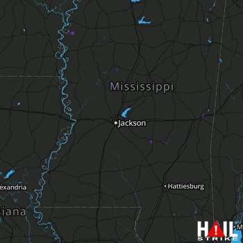 JACKSON (KDGX) RADAR

