This weather event on July 10, 2025 includes:
4 states
32 counties,
7 cities,
and 61 zip codes.
There were total properties that were impacted and have possible damage.
States Impacted By Hail On July 10, 2025
Colorado
·
Kansas
·
Oklahoma
·
Texas
Counties Impacted By Hail On July 10, 2025
Baca, CO
·
Prowers, CO
·
Barton, KS
·
Clark, KS
·
Edwards, KS
·
Ellsworth, KS
·
Finney, KS
·
Ford, KS
·
Grant, KS
·
Gray, KS
·
Hamilton, KS
·
Haskell, KS
·
Hodgeman, KS
·
Kearny, KS
·
Lincoln, KS
·
Logan, KS
·
Meade, KS
·
Morton, KS
·
Ness, KS
·
Norton, KS
·
Pawnee, KS
·
Rawlins, KS
·
Rush, KS
·
Russell, KS
·
Scott, KS
·
Sherman, KS
·
Stanton, KS
·
Stevens, KS
·
Thomas, KS
·
Wichita, KS
·
Cimarron, OK
·
Texas, OK
Cities Impacted By Hail On July 10, 2025
Claflin, KS
·
Dorrance, KS
·
Fowler, KS
·
Holyrood, KS
·
Keyes, OK
·
Syracuse, KS
·
Wilson, KS
Zip Codes Impacted By Hail On July 10, 2025
67427
·
67450
·
67455
·
67459
·
67481
·
67490
·
67511
·
67515
·
67523
·
67525
·
67530
·
67544
·
67547
·
67550
·
67559
·
67560
·
67564
·
67574
·
67575
·
67584
·
67622
·
67626
·
67634
·
67648
·
67654
·
67665
·
67701
·
67730
·
67732
·
67743
·
67744
·
67801
·
67838
·
67841
·
67844
·
67851
·
67854
·
67855
·
67860
·
67862
·
67863
·
67865
·
67870
·
67871
·
67878
·
67880
·
67882
·
67950
·
67951
·
67953
·
67954
·
73939
·
73947
·
73949
·
81029
·
81047
·
81084
·
81090
·
67645
·
67835
·
67861
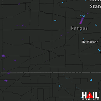 DODGE CITY (KDDC) RADAR

