This weather event on July 8, 2025 includes:
3 states
26 counties,
11 cities,
and 61 zip codes.
There were 313 total properties that were impacted and have possible damage.
States Impacted By Hail On July 8, 2025
North Carolina
·
Tennessee
·
Virginia
Counties Impacted By Hail On July 8, 2025
Rockingham, NC
·
Sullivan, TN
·
Albemarle, VA
·
Amelia, VA
·
Appomattox, VA
·
Botetourt, VA
·
Brunswick, VA
·
Buckingham, VA
·
Chesterfield, VA
·
Cumberland, VA
·
Dinwiddie, VA
·
Fluvanna, VA
·
Giles, VA
·
Goochland, VA
·
Louisa, VA
·
Lunenburg, VA
·
Montgomery, VA
·
Nelson, VA
·
Nottoway, VA
·
Powhatan, VA
·
Prince Edward, VA
·
Roanoke, VA
·
Salem, VA
·
Scott, VA
·
Smyth, VA
·
Wythe, VA
Cities Impacted By Hail On July 8, 2025
Bloomingdale, TN
·
Buckingham Courthouse, VA
·
Cumberland, VA
·
Daleville, VA
·
Goochland, VA
·
Hollins, VA
·
Kenbridge, VA
·
McKenney, VA
·
Reidsville, NC
·
Salem, VA
·
Schuyler, VA
Zip Codes Impacted By Hail On July 8, 2025
22937
·
22969
·
22971
·
23002
·
23004
·
23022
·
23027
·
23038
·
23040
·
23063
·
23065
·
23083
·
23102
·
23112
·
23113
·
23117
·
23120
·
23123
·
23153
·
23821
·
23824
·
23832
·
23833
·
23838
·
23840
·
23857
·
23868
·
23872
·
23876
·
23889
·
23893
·
23920
·
23921
·
23922
·
23930
·
23936
·
23938
·
23944
·
23966
·
24019
·
24060
·
24083
·
24128
·
24153
·
24175
·
24202
·
24258
·
24354
·
24360
·
24370
·
24375
·
24522
·
24553
·
24562
·
24590
·
27320
·
37617
·
37660
·
37664
·
23850
·
23139
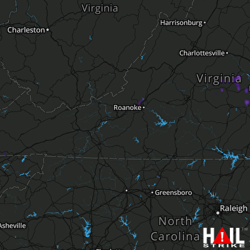 ROANOKE (KFCX) RADAR

