This weather event on July 6, 2025 includes:
4 states
32 counties,
15 cities,
and 69 zip codes.
There were 465 total properties that were impacted and have possible damage.
States Impacted By Hail On July 6, 2025
Alabama
·
Arkansas
·
Louisiana
·
Mississippi
Counties Impacted By Hail On July 6, 2025
Mobile, AL
·
Washington, AL
·
Ashley, AR
·
Bradley, AR
·
Drew, AR
·
East Feliciana, LA
·
Livingston, LA
·
St. Helena, LA
·
Tangipahoa, LA
·
Washington, LA
·
Amite, MS
·
Calhoun, MS
·
Claiborne, MS
·
Clarke, MS
·
Copiah, MS
·
Forrest, MS
·
Franklin, MS
·
George, MS
·
Greene, MS
·
Grenada, MS
·
Harrison, MS
·
Jackson, MS
·
Jefferson, MS
·
Jefferson Davis, MS
·
Lincoln, MS
·
Marion, MS
·
Montgomery, MS
·
Pearl River, MS
·
Perry, MS
·
Pike, MS
·
Walthall, MS
·
Wayne, MS
Cities Impacted By Hail On July 6, 2025
Columbia, MS
·
Denham Springs, LA
·
Franklinton, LA
·
Gulfport, MS
·
Hammond, LA
·
Hattiesburg, MS
·
Kentwood, LA
·
Lyman, MS
·
Magnolia, MS
·
Ponchatoula, LA
·
Prentiss, MS
·
Rawls Springs, MS
·
Tylertown, MS
·
Wade, MS
·
Wilson, LA
Zip Codes Impacted By Hail On July 6, 2025
36518
·
36522
·
36529
·
36539
·
36584
·
38901
·
38913
·
38915
·
38925
·
38929
·
38951
·
39059
·
39144
·
39360
·
39366
·
39401
·
39402
·
39426
·
39429
·
39451
·
39452
·
39462
·
39465
·
39470
·
39474
·
39476
·
39482
·
39483
·
39503
·
39532
·
39562
·
39565
·
39574
·
39601
·
39629
·
39645
·
39647
·
39648
·
39652
·
39653
·
39657
·
39664
·
39666
·
39667
·
39668
·
70401
·
70403
·
70426
·
70427
·
70438
·
70444
·
70446
·
70450
·
70454
·
70455
·
70711
·
70722
·
70744
·
70748
·
70789
·
71642
·
71646
·
71647
·
71655
·
71675
·
70726
·
70441
·
39362
·
38878
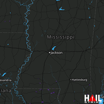 JACKSON (KDGX) RADAR

