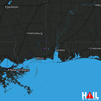
This weather event on July 6, 2025 includes:
4 states
21 counties,
15 cities,
and 47 zip codes.
There were 975 total properties that were impacted and have possible damage.
States Impacted By Hail On July 6, 2025
Alabama
·
Florida
·
Louisiana
·
Mississippi
Counties Impacted By Hail On July 6, 2025
Baldwin, AL
·
Clarke, AL
·
Mobile, AL
·
Washington, AL
·
Escambia, FL
·
Okaloosa, FL
·
Santa Rosa, FL
·
Jefferson, LA
·
Plaquemines, LA
·
St. Bernard, LA
·
Tangipahoa, LA
·
Washington, LA
·
George, MS
·
Greene, MS
·
Hancock, MS
·
Harrison, MS
·
Jackson, MS
·
Marion, MS
·
Pearl River, MS
·
Perry, MS
·
Wayne, MS
Cities Impacted By Hail On July 6, 2025
Bay Minette, AL
·
Chumuckla, FL
·
Citronelle, AL
·
Crestview, FL
·
Daphne, AL
·
Gulfport, MS
·
Hammond, LA
·
Jackson, AL
·
Kenner, LA
·
Latimer, MS
·
Lyman, MS
·
Metairie, LA
·
Mobile, AL
·
Spanish Fort, AL
·
Vancleave, MS
Zip Codes Impacted By Hail On July 6, 2025
32536
·
32565
·
32571
·
32583
·
36502
·
36507
·
36518
·
36522
·
36524
·
36526
·
36527
·
36539
·
36541
·
36544
·
36545
·
36550
·
36575
·
36579
·
36582
·
36584
·
36587
·
36608
·
36727
·
39362
·
39425
·
39451
·
39452
·
39470
·
39476
·
39483
·
39503
·
39520
·
39562
·
39565
·
39574
·
70002
·
70003
·
70006
·
70065
·
70091
·
70401
·
70403
·
70427
·
70450
·
70454
·
70438
·
36521
 MOBILE (KMOB) RADAR

