This weather event on July 5, 2025 includes:
2 states
31 counties,
7 cities,
and 65 zip codes.
There were 430 total properties that were impacted and have possible damage.
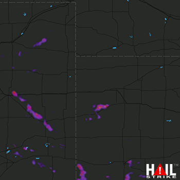 GOODLAND (KGLD) RADAR
States Impacted By Hail On July 5, 2025
Colorado
·
Kansas
Counties Impacted By Hail On July 5, 2025
Adams, CO
·
Baca, CO
·
Bent, CO
·
Cheyenne, CO
·
Crowley, CO
·
Kiowa, CO
·
Kit Carson, CO
·
Lincoln, CO
·
Logan, CO
·
Morgan, CO
·
Otero, CO
·
Phillips, CO
·
Prowers, CO
·
Washington, CO
·
Weld, CO
·
Yuma, CO
·
Finney, KS
·
Grant, KS
·
Gray, KS
·
Greeley, KS
·
Hamilton, KS
·
Haskell, KS
·
Kearny, KS
·
Logan, KS
·
Morton, KS
·
Pawnee, KS
·
Rush, KS
·
Scott, KS
·
Stanton, KS
·
Wallace, KS
·
Wichita, KS
Cities Impacted By Hail On July 5, 2025
Genoa, CO
·
Greeley County unified government (balance), KS
·
Kit Carson, CO
·
Manter, KS
·
Sublette, KS
·
Two Buttes, CO
·
Weskan, KS
Zip Codes Impacted By Hail On July 5, 2025
67574
·
67575
·
67758
·
67761
·
67762
·
67764
·
67835
·
67836
·
67837
·
67846
·
67853
·
67855
·
67857
·
67861
·
67862
·
67863
·
67867
·
67868
·
67870
·
67871
·
67878
·
67879
·
67880
·
67953
·
67954
·
80136
·
80652
·
80701
·
80720
·
80723
·
80731
·
80740
·
80743
·
80757
·
80759
·
80801
·
80802
·
80804
·
80810
·
80812
·
80815
·
80818
·
80821
·
80825
·
80828
·
80834
·
80836
·
80861
·
80862
·
81021
·
81036
·
81041
·
81044
·
81047
·
81050
·
81052
·
81067
·
81071
·
81073
·
81076
·
81084
·
81090
·
67860
·
67877
·
81054

