This weather event on July 4, 2025 includes:
3 states
36 counties,
14 cities,
and 75 zip codes.
There were 698 total properties that were impacted and have possible damage.
States Impacted By Hail On July 4, 2025
Colorado
·
Kansas
·
Oklahoma
Counties Impacted By Hail On July 4, 2025
Kiowa, CO
·
Prowers, CO
·
Decatur, KS
·
Edwards, KS
·
Ellis, KS
·
Finney, KS
·
Ford, KS
·
Gove, KS
·
Grant, KS
·
Gray, KS
·
Greeley, KS
·
Hamilton, KS
·
Haskell, KS
·
Hodgeman, KS
·
Kearny, KS
·
Kiowa, KS
·
Lane, KS
·
Logan, KS
·
Meade, KS
·
Morton, KS
·
Ness, KS
·
Norton, KS
·
Osborne, KS
·
Pawnee, KS
·
Rawlins, KS
·
Rooks, KS
·
Scott, KS
·
Seward, KS
·
Sheridan, KS
·
Stanton, KS
·
Stevens, KS
·
Thomas, KS
·
Trego, KS
·
Wichita, KS
·
Beaver, OK
·
Texas, OK
Cities Impacted By Hail On July 4, 2025
Dodge City, KS
·
Greeley County unified government (balance), KS
·
Horace, KS
·
Kismet, KS
·
Manter, KS
·
Munjor, KS
·
Richfield, KS
·
Rolla, KS
·
Russell Springs, KS
·
Spearville, KS
·
Syracuse, KS
·
Tribune, KS
·
Ulysses, KS
·
Wilroads Gardens, KS
Zip Codes Impacted By Hail On July 4, 2025
67054
·
67109
·
67518
·
67547
·
67550
·
67560
·
67584
·
67601
·
67623
·
67629
·
67631
·
67635
·
67643
·
67653
·
67671
·
67675
·
67736
·
67738
·
67740
·
67747
·
67748
·
67752
·
67753
·
67757
·
67761
·
67764
·
67801
·
67834
·
67835
·
67838
·
67839
·
67841
·
67842
·
67846
·
67850
·
67851
·
67853
·
67854
·
67855
·
67857
·
67859
·
67860
·
67861
·
67862
·
67863
·
67864
·
67869
·
67870
·
67871
·
67876
·
67877
·
67878
·
67879
·
67880
·
67882
·
67901
·
67950
·
67952
·
67953
·
67954
·
73844
·
73848
·
73931
·
73932
·
73938
·
73942
·
73944
·
73945
·
73950
·
73951
·
81047
·
81071
·
67669
·
67749
·
67951
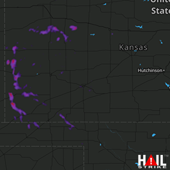 DODGE CITY (KDDC) RADAR

