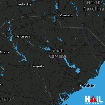
This weather event on July 4, 2025 includes:
3 states
33 counties,
21 cities,
and 71 zip codes.
There were 1581 total properties that were impacted and have possible damage.
States Impacted By Hail On July 4, 2025
Georgia
·
North Carolina
·
South Carolina
Counties Impacted By Hail On July 4, 2025
Bryan, GA
·
Bulloch, GA
·
Burke, GA
·
Emanuel, GA
·
Evans, GA
·
Jenkins, GA
·
Richmond, GA
·
Screven, GA
·
Tattnall, GA
·
Bladen, NC
·
Columbus, NC
·
Richmond, NC
·
Robeson, NC
·
Scotland, NC
·
Aiken, SC
·
Allendale, SC
·
Bamberg, SC
·
Barnwell, SC
·
Calhoun, SC
·
Chesterfield, SC
·
Darlington, SC
·
Dillon, SC
·
Fairfield, SC
·
Horry, SC
·
Kershaw, SC
·
Lee, SC
·
Lexington, SC
·
Marion, SC
·
Marlboro, SC
·
Newberry, SC
·
Orangeburg, SC
·
Richland, SC
·
Sumter, SC
Cities Impacted By Hail On July 4, 2025
Augusta-Richmond County consolidated government (balance), GA
·
Cayce, SC
·
Chadbourn, NC
·
Gadsden, SC
·
Latta, SC
·
Lexington, SC
·
Manassas, GA
·
McDonald, NC
·
Millen, GA
·
Mullins, SC
·
Nichols, SC
·
North, SC
·
North Augusta, SC
·
Proctorville, NC
·
Raynham, NC
·
Red Bank, SC
·
South Congaree, SC
·
Sumter, SC
·
Swainsboro, GA
·
Wallace, SC
·
Wedgefield, SC
Zip Codes Impacted By Hail On July 4, 2025
28320
·
28340
·
28360
·
28363
·
28369
·
28375
·
28377
·
28379
·
28383
·
28430
·
28431
·
28433
·
28438
·
28472
·
29009
·
29010
·
29015
·
29044
·
29052
·
29061
·
29069
·
29072
·
29073
·
29080
·
29104
·
29107
·
29118
·
29135
·
29150
·
29153
·
29154
·
29160
·
29161
·
29170
·
29178
·
29532
·
29536
·
29543
·
29565
·
29571
·
29574
·
29581
·
29592
·
29596
·
29709
·
29718
·
29810
·
29812
·
29817
·
29836
·
29841
·
30401
·
30415
·
30417
·
30421
·
30426
·
30438
·
30441
·
30442
·
30456
·
30467
·
30471
·
30822
·
30830
·
30904
·
30906
·
30909
·
31321
·
29584
·
29168
·
29112
 COLUMBIA (KCAE) RADAR

