This weather event on July 1, 2025 includes:
3 states
26 counties,
23 cities,
and 61 zip codes.
There were total properties that were impacted and have possible damage.
States Impacted By Hail On July 1, 2025
Arkansas
·
Louisiana
·
Mississippi
Counties Impacted By Hail On July 1, 2025
Ashley, AR
·
Union, AR
·
Avoyelles, LA
·
Caldwell, LA
·
Catahoula, LA
·
Concordia, LA
·
East Carroll, LA
·
East Feliciana, LA
·
Franklin, LA
·
Jackson, LA
·
Madison, LA
·
Morehouse, LA
·
Ouachita, LA
·
Richland, LA
·
St. Helena, LA
·
Tensas, LA
·
Union, LA
·
West Carroll, LA
·
West Feliciana, LA
·
Adams, MS
·
Amite, MS
·
Claiborne, MS
·
Franklin, MS
·
Jefferson, MS
·
Warren, MS
·
Wilkinson, MS
Cities Impacted By Hail On July 1, 2025
Alcorn State University, MS
·
Banks Springs, LA
·
Bude, MS
·
Centreville, MS
·
Cloverdale, MS
·
Columbia, LA
·
Delhi, LA
·
Delta, LA
·
Fayette, MS
·
Felsenthal, AR
·
Huttig, AR
·
Junction City, AR
·
Liberty, MS
·
Mangham, LA
·
Marion, LA
·
Meadville, MS
·
Mound, LA
·
Natchez, MS
·
Newellton, LA
·
Norwood, LA
·
Oak Ridge, LA
·
Sterlington, LA
·
Vicksburg, MS
Zip Codes Impacted By Hail On July 1, 2025
39069
·
39086
·
39096
·
39120
·
39150
·
39175
·
39180
·
39183
·
39630
·
39631
·
39633
·
39638
·
39645
·
39653
·
39661
·
39664
·
39669
·
70441
·
70761
·
70775
·
70789
·
71202
·
71203
·
71219
·
71220
·
71229
·
71232
·
71233
·
71237
·
71238
·
71241
·
71243
·
71254
·
71259
·
71260
·
71261
·
71264
·
71266
·
71269
·
71276
·
71277
·
71280
·
71282
·
71286
·
71291
·
71292
·
71295
·
71336
·
71351
·
71357
·
71366
·
71368
·
71373
·
71375
·
71418
·
71435
·
71635
·
71730
·
71747
·
71749
·
71765
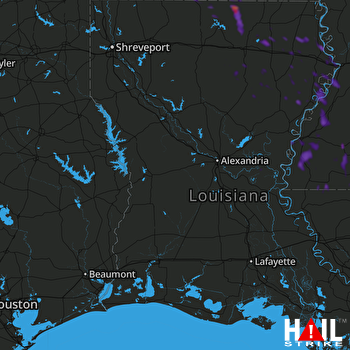 FORT POLK (KPOE) RADAR

