This weather event on June 27, 2025 includes:
4 states
19 counties,
29 cities,
and 66 zip codes.
There were total properties that were impacted and have possible damage.
States Impacted By Hail On June 27, 2025
Illinois
·
Indiana
·
Kentucky
·
Ohio
Counties Impacted By Hail On June 27, 2025
Champaign, IL
·
Coles, IL
·
De Witt, IL
·
Douglas, IL
·
Macon, IL
·
Piatt, IL
·
Dearborn, IN
·
Henry, IN
·
Perry, IN
·
Boone, KY
·
Bracken, KY
·
Breckinridge, KY
·
Campbell, KY
·
Hancock, KY
·
Kenton, KY
·
Ohio, KY
·
Brown, OH
·
Clermont, OH
·
Hamilton, OH
Cities Impacted By Hail On June 27, 2025
Bellevue, KY
·
Bright, IN
·
Burlington, KY
·
Cannelton, IN
·
Cincinnati, OH
·
Covington, KY
·
Dayton, KY
·
Florence, KY
·
Fort Thomas, KY
·
Georgetown, OH
·
Hamersville, OH
·
Harrison, OH
·
Ivesdale, IL
·
Lake Waynoka, OH
·
Ludlow, KY
·
Madeira, OH
·
Maroa, IL
·
Mattoon, IL
·
Monticello, IL
·
Newport, KY
·
Norwood, OH
·
Oakbrook, KY
·
Pesotum, IL
·
Sadorus, IL
·
Silverton, OH
·
St. Bernard, OH
·
Tell City, IN
·
West Harrison, IN
·
White Heath, IL
Zip Codes Impacted By Hail On June 27, 2025
40119
·
41002
·
41005
·
41011
·
41016
·
41018
·
41042
·
41043
·
41071
·
41073
·
41074
·
41075
·
41091
·
42343
·
42348
·
45030
·
45106
·
45120
·
45121
·
45130
·
45168
·
45171
·
45202
·
45203
·
45204
·
45205
·
45206
·
45207
·
45208
·
45220
·
45225
·
45226
·
45227
·
45229
·
45236
·
45243
·
45697
·
47025
·
47060
·
47362
·
47520
·
47586
·
61756
·
61802
·
61813
·
61822
·
61839
·
61851
·
61854
·
61856
·
61863
·
61872
·
61875
·
61880
·
61884
·
61910
·
61913
·
61931
·
61938
·
61953
·
45209
·
45212
·
45213
·
45214
·
45217
·
45219
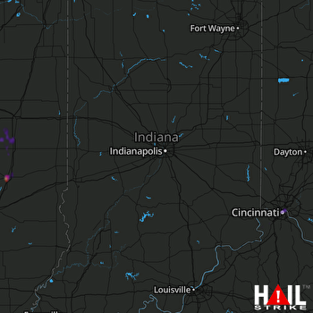 INDIANAPOLIS (KIND) RADAR

