This weather event on June 25, 2025 includes:
3 states
30 counties,
17 cities,
and 77 zip codes.
There were total properties that were impacted and have possible damage.
States Impacted By Hail On June 25, 2025
Iowa
·
Minnesota
·
Wisconsin
Counties Impacted By Hail On June 25, 2025
Cerro Gordo, IA
·
Chickasaw, IA
·
Floyd, IA
·
Franklin, IA
·
Hancock, IA
·
Howard, IA
·
Humboldt, IA
·
Kossuth, IA
·
Mitchell, IA
·
Winnebago, IA
·
Winneshiek, IA
·
Worth, IA
·
Wright, IA
·
Blue Earth, MN
·
Faribault, MN
·
Fillmore, MN
·
Freeborn, MN
·
Goodhue, MN
·
Houston, MN
·
Mower, MN
·
Rice, MN
·
Steele, MN
·
Wabasha, MN
·
Waseca, MN
·
Winona, MN
·
Buffalo, WI
·
Dunn, WI
·
La Crosse, WI
·
Pepin, WI
·
Vernon, WI
Cities Impacted By Hail On June 25, 2025
Albert Lea, MN
·
Alexander, IA
·
Belmond, IA
·
Burt, IA
·
Caledonia, MN
·
Canton, MN
·
Faribault, MN
·
Freeborn, MN
·
Hokah, MN
·
Lake Mills, IA
·
Lime Springs, IA
·
Lone Rock, IA
·
Ostrander, MN
·
Renwick, IA
·
Warsaw, MN
·
Waseca, MN
·
Woden, IA
Zip Codes Impacted By Hail On June 25, 2025
50401
·
50420
·
50421
·
50423
·
50436
·
50439
·
50450
·
50452
·
50453
·
50457
·
50459
·
50461
·
50466
·
50468
·
50469
·
50477
·
50479
·
50480
·
50484
·
50511
·
50522
·
50525
·
50559
·
50577
·
50598
·
50616
·
52132
·
52136
·
52144
·
52154
·
52155
·
52171
·
54629
·
54636
·
54644
·
54736
·
54737
·
55021
·
55060
·
55912
·
55919
·
55921
·
55922
·
55939
·
55941
·
55943
·
55946
·
55947
·
55949
·
55951
·
55956
·
55959
·
55961
·
55962
·
55965
·
55969
·
55971
·
55974
·
55983
·
55990
·
55991
·
56007
·
56010
·
56013
·
56023
·
56032
·
56042
·
56065
·
56078
·
56093
·
56097
·
56098
·
50447
·
50475
·
50542
·
55975
·
56048
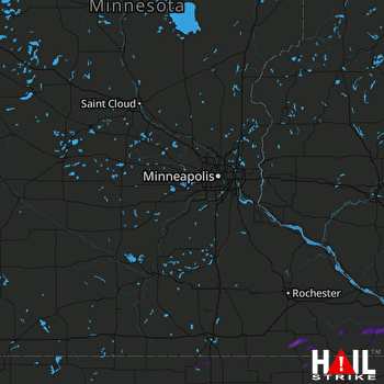 MINNEAPOLIS (KMPX) RADAR

