This weather event on June 25, 2025 includes:
4 states
28 counties,
19 cities,
and 82 zip codes.
There were total properties that were impacted and have possible damage.
States Impacted By Hail On June 25, 2025
Iowa
·
Minnesota
·
Nebraska
·
South Dakota
Counties Impacted By Hail On June 25, 2025
Buena Vista, IA
·
Calhoun, IA
·
Cherokee, IA
·
Crawford, IA
·
Hancock, IA
·
Humboldt, IA
·
Ida, IA
·
Kossuth, IA
·
Monona, IA
·
Pocahontas, IA
·
Sac, IA
·
Webster, IA
·
Winnebago, IA
·
Woodbury, IA
·
Faribault, MN
·
Antelope, NE
·
Boone, NE
·
Burt, NE
·
Colfax, NE
·
Cuming, NE
·
Dodge, NE
·
Madison, NE
·
Platte, NE
·
Stanton, NE
·
Thurston, NE
·
Washington, NE
·
Wheeler, NE
·
Minnehaha, SD
Cities Impacted By Hail On June 25, 2025
Blencoe, IA
·
Blue Earth, MN
·
Craig, NE
·
Macy, NE
·
Madison, NE
·
Newman Grove, NE
·
Nickerson, NE
·
Oakland, NE
·
Oto, IA
·
Pioneer, IA
·
Pomeroy, IA
·
Rodney, IA
·
Rosalie, NE
·
Scribner, NE
·
Smithland, IA
·
Tarnov, NE
·
Turin, IA
·
West Point, NE
·
Whiting, IA
Zip Codes Impacted By Hail On June 25, 2025
50480
·
50484
·
50524
·
50535
·
50541
·
50567
·
50568
·
50575
·
50583
·
51002
·
51004
·
51006
·
51010
·
51016
·
51019
·
51025
·
51026
·
51033
·
51034
·
51040
·
51044
·
51047
·
51049
·
51051
·
51056
·
51060
·
51061
·
51063
·
51431
·
51433
·
51439
·
51442
·
51445
·
51450
·
51458
·
51461
·
51523
·
51558
·
51572
·
56013
·
56027
·
57020
·
57055
·
68019
·
68020
·
68025
·
68029
·
68031
·
68038
·
68039
·
68044
·
68055
·
68057
·
68061
·
68063
·
68601
·
68620
·
68621
·
68631
·
68633
·
68636
·
68641
·
68642
·
68643
·
68644
·
68649
·
68652
·
68653
·
68659
·
68660
·
68661
·
68665
·
68716
·
68748
·
68758
·
68779
·
68788
·
50424
·
50571
·
57107
·
68045
·
68629
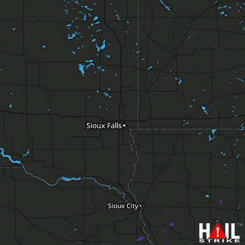 SIOUX FALLS (KFSD) RADAR

