This weather event on June 24, 2025 includes:
4 states
21 counties,
16 cities,
and 59 zip codes.
There were 200 total properties that were impacted and have possible damage.
States Impacted By Hail On June 24, 2025
Iowa
·
Illinois
·
Missouri
·
Wisconsin
Counties Impacted By Hail On June 24, 2025
Clayton, IA
·
Davis, IA
·
Fayette, IA
·
Linn, IA
·
Van Buren, IA
·
Bureau, IL
·
Cook, IL
·
Henry, IL
·
Knox, IL
·
LaSalle, IL
·
Marshall, IL
·
Peoria, IL
·
Putnam, IL
·
Stark, IL
·
Will, IL
·
Adair, MO
·
Clark, MO
·
Knox, MO
·
Scotland, MO
·
Crawford, WI
·
Grant, WI
Cities Impacted By Hail On June 24, 2025
Annawan, IL
·
Cambridge, IL
·
Cantril, IA
·
Dalzell, IL
·
Frankfort, IL
·
Ladd, IL
·
LaSalle, IL
·
Milton, IA
·
Mokena, IL
·
Mount Sterling, IA
·
Orland Hills, IL
·
Orland Park, IL
·
Patch Grove, WI
·
Peru, IL
·
Spring Valley, IL
·
Tinley Park, IL
Zip Codes Impacted By Hail On June 24, 2025
52043
·
52141
·
52142
·
52164
·
52175
·
52213
·
52537
·
52542
·
52570
·
52572
·
52584
·
53801
·
53804
·
53805
·
53813
·
53816
·
53817
·
53821
·
53826
·
60423
·
60448
·
60462
·
60467
·
60477
·
60487
·
61234
·
61235
·
61238
·
61283
·
61301
·
61312
·
61314
·
61320
·
61327
·
61329
·
61344
·
61354
·
61361
·
61362
·
61368
·
61376
·
61434
·
61443
·
61449
·
61458
·
61483
·
61489
·
61529
·
61537
·
61559
·
61560
·
61572
·
63453
·
63547
·
63555
·
63533
·
61517
·
52573
·
52072
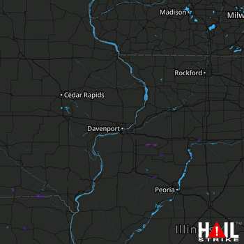 DAVENPORT (KDVN) RADAR

