This weather event on June 24, 2025 includes:
3 states
28 counties,
10 cities,
and 63 zip codes.
There were 55 total properties that were impacted and have possible damage.
States Impacted By Hail On June 24, 2025
Kansas
·
Oklahoma
·
Texas
Counties Impacted By Hail On June 24, 2025
Barton, KS
·
Clark, KS
·
Edwards, KS
·
Ellsworth, KS
·
Finney, KS
·
Ford, KS
·
Gray, KS
·
Greeley, KS
·
Hodgeman, KS
·
Kiowa, KS
·
Lane, KS
·
Lincoln, KS
·
McPherson, KS
·
Meade, KS
·
Morton, KS
·
Ottawa, KS
·
Rawlins, KS
·
Reno, KS
·
Rice, KS
·
Stafford, KS
·
Stevens, KS
·
Thomas, KS
·
Wallace, KS
·
Beaver, OK
·
Texas, OK
·
Hansford, TX
·
Ochiltree, TX
·
Sherman, TX
Cities Impacted By Hail On June 24, 2025
Canton, KS
·
Cimarron, KS
·
Dodge City, KS
·
Greeley County unified government (balance), KS
·
Guymon, OK
·
Hardesty, OK
·
Hutchinson, KS
·
Jetmore, KS
·
Kanopolis, KS
·
Rolla, KS
Zip Codes Impacted By Hail On June 24, 2025
67109
·
67418
·
67428
·
67439
·
67443
·
67444
·
67448
·
67454
·
67455
·
67457
·
67459
·
67460
·
67464
·
67467
·
67490
·
67491
·
67501
·
67502
·
67525
·
67526
·
67530
·
67544
·
67546
·
67547
·
67561
·
67563
·
67566
·
67570
·
67573
·
67578
·
67579
·
67701
·
67762
·
67801
·
67831
·
67835
·
67839
·
67841
·
67842
·
67844
·
67854
·
67864
·
67865
·
67879
·
67882
·
67950
·
67951
·
67954
·
73931
·
73932
·
73938
·
73939
·
73942
·
73944
·
73949
·
73950
·
79033
·
79040
·
79070
·
79081
·
67054
·
67450
·
67876
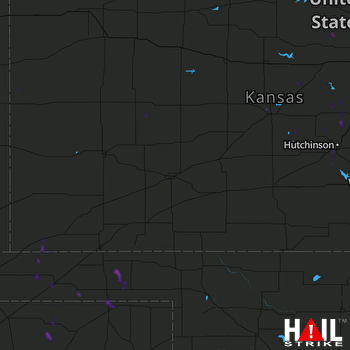 DODGE CITY (KDDC) RADAR

