This weather event on June 20, 2025 includes:
1 states
21 counties,
11 cities,
and 72 zip codes.
There were 835 total properties that were impacted and have possible damage.
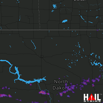 MINOT AFB (KMBX) RADAR
States Impacted By Hail On June 20, 2025
North Dakota
Counties Impacted By Hail On June 20, 2025
Barnes, ND
·
Benson, ND
·
Billings, ND
·
Burleigh, ND
·
Cavalier, ND
·
Dunn, ND
·
Eddy, ND
·
Foster, ND
·
Grant, ND
·
Griggs, ND
·
Hettinger, ND
·
Kidder, ND
·
McLean, ND
·
Mercer, ND
·
Morton, ND
·
Nelson, ND
·
Oliver, ND
·
Sheridan, ND
·
Stark, ND
·
Stutsman, ND
·
Wells, ND
Cities Impacted By Hail On June 20, 2025
Carrington, ND
·
Cathay, ND
·
Denhoff, ND
·
Fessenden, ND
·
Harmon, ND
·
Hurdsfield, ND
·
Jamestown, ND
·
Killdeer, ND
·
Regan, ND
·
Sykeston, ND
·
Warwick, ND
Zip Codes Impacted By Hail On June 20, 2025
58254
·
58259
·
58341
·
58344
·
58356
·
58361
·
58372
·
58374
·
58380
·
58381
·
58401
·
58405
·
58416
·
58418
·
58421
·
58422
·
58423
·
58424
·
58429
·
58430
·
58438
·
58444
·
58445
·
58448
·
58451
·
58463
·
58464
·
58475
·
58476
·
58477
·
58478
·
58479
·
58486
·
58488
·
58492
·
58494
·
58496
·
58503
·
58520
·
58521
·
58523
·
58530
·
58533
·
58535
·
58540
·
58545
·
58554
·
58558
·
58559
·
58562
·
58563
·
58571
·
58572
·
58576
·
58577
·
58579
·
58601
·
58622
·
58626
·
58627
·
58630
·
58631
·
58638
·
58640
·
58642
·
58646
·
58652
·
58656
·
58710
·
58723
·
58757
·
58758

