This weather event on June 19, 2025 includes:
6 states
23 counties,
12 cities,
and 64 zip codes.
There were 22 total properties that were impacted and have possible damage.
States Impacted By Hail On June 19, 2025
Kentucky
·
North Carolina
·
South Carolina
·
Tennessee
·
Virginia
·
West Virginia
Counties Impacted By Hail On June 19, 2025
Breathitt, KY
·
Floyd, KY
·
Knott, KY
·
Lee, KY
·
Owsley, KY
·
Pike, KY
·
Wolfe, KY
·
Alexander, NC
·
Burke, NC
·
Caldwell, NC
·
Iredell, NC
·
Rutherford, NC
·
Watauga, NC
·
Wilkes, NC
·
Yadkin, NC
·
Greenville, SC
·
Grainger, TN
·
Jefferson, TN
·
Knox, TN
·
Buchanan, VA
·
Lee, VA
·
Tazewell, VA
·
McDowell, WV
Cities Impacted By Hail On June 19, 2025
Berwind, WV
·
Coal Run Village, KY
·
Jackson, KY
·
Jefferson City, TN
·
Lenoir, NC
·
Martin, KY
·
Maytown, KY
·
McDowell, KY
·
Moravian Falls, NC
·
New Market, TN
·
Pikeville, KY
·
Travelers Rest, SC
Zip Codes Impacted By Hail On June 19, 2025
24243
·
24244
·
24603
·
24609
·
24614
·
24651
·
24815
·
24826
·
24836
·
24866
·
24884
·
24894
·
28018
·
28020
·
28040
·
28606
·
28611
·
28618
·
28624
·
28625
·
28634
·
28636
·
28645
·
28654
·
28655
·
28659
·
28660
·
28681
·
28689
·
28697
·
29690
·
37709
·
37721
·
37760
·
37820
·
41301
·
41311
·
41314
·
41339
·
41366
·
41385
·
41501
·
41512
·
41522
·
41534
·
41539
·
41548
·
41557
·
41572
·
41615
·
41619
·
41622
·
41631
·
41635
·
41640
·
41645
·
41647
·
41655
·
41667
·
24219
·
24637
·
27020
·
41562
·
41649
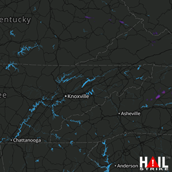 KNOXVILLE (KMRX) RADAR

