This weather event on June 17, 2025 includes:
4 states
22 counties,
18 cities,
and 45 zip codes.
There were 87 total properties that were impacted and have possible damage.
States Impacted By Hail On June 17, 2025
Arkansas
·
Kansas
·
Missouri
·
Oklahoma
Counties Impacted By Hail On June 17, 2025
Benton, AR
·
Crawford, KS
·
Montgomery, KS
·
Crawford, MO
·
Dade, MO
·
Dallas, MO
·
Franklin, MO
·
Gasconade, MO
·
Maries, MO
·
Phelps, MO
·
Polk, MO
·
Adair, OK
·
Cherokee, OK
·
Craig, OK
·
Delaware, OK
·
Mayes, OK
·
Nowata, OK
·
Osage, OK
·
Ottawa, OK
·
Rogers, OK
·
Wagoner, OK
·
Washington, OK
Cities Impacted By Hail On June 17, 2025
Bartlesville, OK
·
Bland, MO
·
Bourbon, MO
·
Briggs, OK
·
Copan, OK
·
Delaware, OK
·
Dewey, OK
·
Dripping Springs, OK
·
Eldon, OK
·
Flint Creek, OK
·
Grove, OK
·
Scraper, OK
·
Siloam Springs, AR
·
Twin Oaks, OK
·
Vera, OK
·
Vinita, OK
·
West Siloam Springs, OK
·
White Oak, OK
Zip Codes Impacted By Hail On June 17, 2025
63080
·
65013
·
65441
·
65449
·
65453
·
65559
·
65565
·
65590
·
65601
·
65603
·
65613
·
65640
·
65649
·
65661
·
65663
·
65674
·
65722
·
66762
·
67301
·
67344
·
72761
·
74003
·
74006
·
74022
·
74027
·
74029
·
74042
·
74048
·
74080
·
74083
·
74301
·
74331
·
74338
·
74344
·
74347
·
74352
·
74359
·
74434
·
74441
·
74457
·
74464
·
74960
·
74964
·
74965
·
65014
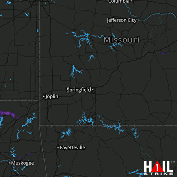 SPRINGFIELD (KSGF) RADAR

