This weather event on June 17, 2025 includes:
3 states
23 counties,
24 cities,
and 66 zip codes.
There were 275 total properties that were impacted and have possible damage.
States Impacted By Hail On June 17, 2025
Iowa
·
Minnesota
·
Wisconsin
Counties Impacted By Hail On June 17, 2025
Butler, IA
·
Cerro Gordo, IA
·
Floyd, IA
·
Franklin, IA
·
Hancock, IA
·
Humboldt, IA
·
Kossuth, IA
·
Palo Alto, IA
·
Pocahontas, IA
·
Wright, IA
·
Aitkin, MN
·
Benton, MN
·
Cass, MN
·
Crow Wing, MN
·
Kanabec, MN
·
Mille Lacs, MN
·
Morrison, MN
·
Otter Tail, MN
·
Pine, MN
·
Pope, MN
·
Stearns, MN
·
Todd, MN
·
Douglas, WI
Cities Impacted By Hail On June 17, 2025
Baxter, MN
·
Bode, IA
·
Brainerd, MN
·
Breezy Point, MN
·
Crosslake, MN
·
Curlew, IA
·
Cylinder, IA
·
Eagle Bend, MN
·
East Gull Lake, MN
·
Emmetsburg, IA
·
Goodell, IA
·
Kanawha, IA
·
Lake Shore, MN
·
Little Falls, MN
·
Livermore, IA
·
Lu Verne, IA
·
Mallard, IA
·
Melrose, MN
·
Ottosen, IA
·
Parkers Prairie, MN
·
Royalton, MN
·
Sheffield, IA
·
St. Joseph, IA
·
West Bend, IA
Zip Codes Impacted By Hail On June 17, 2025
50430
·
50433
·
50439
·
50447
·
50449
·
50469
·
50475
·
50477
·
50511
·
50515
·
50519
·
50520
·
50527
·
50528
·
50536
·
50542
·
50545
·
50558
·
50560
·
50562
·
50570
·
50577
·
50581
·
50597
·
50598
·
50636
·
50653
·
54830
·
54836
·
54873
·
55072
·
55712
·
55735
·
56327
·
56336
·
56338
·
56345
·
56347
·
56349
·
56350
·
56352
·
56359
·
56361
·
56367
·
56373
·
56378
·
56381
·
56386
·
56401
·
56425
·
56431
·
56437
·
56440
·
56441
·
56442
·
56444
·
56446
·
56465
·
56468
·
56472
·
56473
·
56475
·
56551
·
56588
·
56342
·
54838
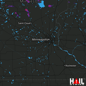 MINNEAPOLIS (KMPX) RADAR

