This weather event on June 17, 2025 includes:
2 states
26 counties,
20 cities,
and 66 zip codes.
There were total properties that were impacted and have possible damage.
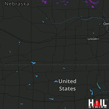 HASTINGS (KUEX) RADAR
States Impacted By Hail On June 17, 2025
Kansas
·
Nebraska
Counties Impacted By Hail On June 17, 2025
Barton, KS
·
Graham, KS
·
McPherson, KS
·
Ness, KS
·
Norton, KS
·
Rice, KS
·
Rush, KS
·
Sheridan, KS
·
Stafford, KS
·
Antelope, NE
·
Boone, NE
·
Butler, NE
·
Cuming, NE
·
Dodge, NE
·
Garfield, NE
·
Hitchcock, NE
·
Holt, NE
·
Madison, NE
·
Nance, NE
·
Pierce, NE
·
Rock, NE
·
Saunders, NE
·
Stanton, NE
·
Valley, NE
·
Wayne, NE
·
Wheeler, NE
Cities Impacted By Hail On June 17, 2025
Albert, KS
·
Alden, KS
·
Beemer, NE
·
Bison, KS
·
Canton, KS
·
Galva, KS
·
La Crosse, KS
·
Little River, KS
·
Lyons, KS
·
McPherson, KS
·
Meadow Grove, NE
·
Norfolk, NE
·
Pilger, NE
·
Raymond, KS
·
Stanton, NE
·
Sterling, KS
·
Tilden, NE
·
Timken, KS
·
West Point, NE
·
Windom, KS
Zip Codes Impacted By Hail On June 17, 2025
67427
·
67428
·
67443
·
67444
·
67457
·
67460
·
67464
·
67491
·
67511
·
67512
·
67513
·
67516
·
67520
·
67521
·
67524
·
67526
·
67530
·
67545
·
67546
·
67548
·
67554
·
67556
·
67559
·
67564
·
67565
·
67567
·
67573
·
67575
·
67576
·
67579
·
67629
·
67650
·
67740
·
68065
·
68620
·
68622
·
68623
·
68626
·
68629
·
68633
·
68636
·
68637
·
68638
·
68641
·
68652
·
68665
·
68701
·
68711
·
68713
·
68714
·
68716
·
68725
·
68726
·
68735
·
68740
·
68752
·
68768
·
68779
·
68781
·
68788
·
68791
·
68815
·
68823
·
68862
·
69043
·
69044

