This weather event on June 17, 2025 includes:
3 states
22 counties,
23 cities,
and 55 zip codes.
There were total properties that were impacted and have possible damage.
States Impacted By Hail On June 17, 2025
Arkansas
·
Louisiana
·
Mississippi
Counties Impacted By Hail On June 17, 2025
Ashley, AR
·
Union, AR
·
Acadia, LA
·
Claiborne, LA
·
East Baton Rouge, LA
·
East Carroll, LA
·
East Feliciana, LA
·
Franklin, LA
·
Iberia, LA
·
Lafayette, LA
·
Madison, LA
·
Morehouse, LA
·
Ouachita, LA
·
Richland, LA
·
St. Martin, LA
·
Tensas, LA
·
Union, LA
·
Vermilion, LA
·
West Carroll, LA
·
West Feliciana, LA
·
Claiborne, MS
·
Warren, MS
Cities Impacted By Hail On June 17, 2025
Bastrop, LA
·
Broussard, LA
·
Cade, LA
·
Central, LA
·
Collinston, LA
·
Delhi, LA
·
El Dorado, AR
·
Epps, LA
·
Farmerville, LA
·
Felsenthal, AR
·
Huttig, AR
·
Jackson, LA
·
Junction City, LA
·
Lydia, LA
·
Marion, LA
·
Mer Rouge, LA
·
Newellton, LA
·
New Iberia, LA
·
Oak Ridge, LA
·
Start, LA
·
Sterlington, LA
·
Strong, AR
·
Youngsville, LA
Zip Codes Impacted By Hail On June 17, 2025
39086
·
39150
·
39183
·
70510
·
70513
·
70517
·
70518
·
70519
·
70542
·
70544
·
70548
·
70552
·
70559
·
70560
·
70563
·
70582
·
70592
·
70714
·
70748
·
70770
·
70775
·
70791
·
71038
·
71079
·
71203
·
71219
·
71220
·
71222
·
71223
·
71229
·
71232
·
71237
·
71241
·
71254
·
71256
·
71260
·
71261
·
71263
·
71264
·
71266
·
71269
·
71276
·
71277
·
71279
·
71280
·
71282
·
71286
·
71295
·
71357
·
71366
·
71635
·
71730
·
71747
·
71749
·
71765
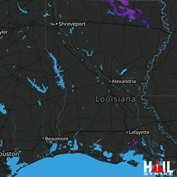 FORT POLK (KPOE) RADAR

