This weather event on June 15, 2025 includes:
2 states
23 counties,
11 cities,
and 65 zip codes.
There were 1580 total properties that were impacted and have possible damage.
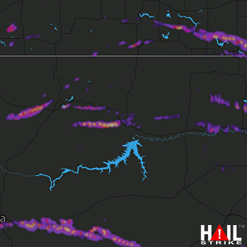 GLASGOW (KGGW) RADAR
States Impacted By Hail On June 15, 2025
Montana
·
North Dakota
Counties Impacted By Hail On June 15, 2025
Blaine, MT
·
Chouteau, MT
·
Custer, MT
·
Daniels, MT
·
Dawson, MT
·
Fallon, MT
·
Fergus, MT
·
Garfield, MT
·
Hill, MT
·
McCone, MT
·
Musselshell, MT
·
Petroleum, MT
·
Phillips, MT
·
Prairie, MT
·
Richland, MT
·
Roosevelt, MT
·
Rosebud, MT
·
Sheridan, MT
·
Valley, MT
·
Wibaux, MT
·
Divide, ND
·
McKenzie, ND
·
Williams, ND
Cities Impacted By Hail On June 15, 2025
Brockton, MT
·
Culbertson, MT
·
Dodson, MT
·
Fort Belknap Agency, MT
·
Fortuna, ND
·
Fox Lake, MT
·
Grass Range, MT
·
Hinsdale, MT
·
Richey, MT
·
St. Marie, MT
·
Winnett, MT
Zip Codes Impacted By Hail On June 15, 2025
58801
·
58831
·
58838
·
58844
·
58845
·
59032
·
59039
·
59058
·
59077
·
59087
·
59201
·
59212
·
59213
·
59218
·
59219
·
59223
·
59225
·
59226
·
59230
·
59241
·
59242
·
59243
·
59247
·
59248
·
59250
·
59252
·
59253
·
59255
·
59256
·
59258
·
59259
·
59260
·
59261
·
59263
·
59270
·
59274
·
59275
·
59301
·
59318
·
59322
·
59326
·
59327
·
59336
·
59337
·
59338
·
59344
·
59347
·
59353
·
59430
·
59441
·
59451
·
59471
·
59489
·
59501
·
59520
·
59523
·
59524
·
59526
·
59529
·
59535
·
59544
·
59072
·
59222
·
59457
·
59538

