This weather event on June 15, 2025 includes:
1 states
18 counties,
14 cities,
and 56 zip codes.
There were 5119 total properties that were impacted and have possible damage.
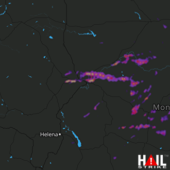 GREAT FALLS (KTFX) RADAR
States Impacted By Hail On June 15, 2025
Montana
Counties Impacted By Hail On June 15, 2025
Blaine, MT
·
Broadwater, MT
·
Cascade, MT
·
Chouteau, MT
·
Fergus, MT
·
Gallatin, MT
·
Golden Valley, MT
·
Hill, MT
·
Jefferson, MT
·
Judith Basin, MT
·
Lewis and Clark, MT
·
Liberty, MT
·
Meagher, MT
·
Musselshell, MT
·
Park, MT
·
Petroleum, MT
·
Teton, MT
·
Wheatland, MT
Cities Impacted By Hail On June 15, 2025
Augusta, MT
·
Black Eagle, MT
·
Denton, MT
·
Fort Belknap Agency, MT
·
Fort Benton, MT
·
Fort Shaw, MT
·
Geraldine, MT
·
Great Falls, MT
·
Highwood, MT
·
Moore, MT
·
Sun Prairie, MT
·
Sun River, MT
·
Vaughn, MT
·
Winston, MT
Zip Codes Impacted By Hail On June 15, 2025
59032
·
59036
·
59046
·
59047
·
59053
·
59072
·
59074
·
59085
·
59087
·
59404
·
59405
·
59410
·
59412
·
59414
·
59416
·
59421
·
59422
·
59424
·
59430
·
59436
·
59440
·
59441
·
59442
·
59443
·
59446
·
59447
·
59450
·
59451
·
59452
·
59453
·
59456
·
59457
·
59460
·
59462
·
59464
·
59468
·
59479
·
59480
·
59483
·
59487
·
59489
·
59501
·
59520
·
59522
·
59523
·
59526
·
59535
·
59634
·
59642
·
59644
·
59645
·
59647
·
59715
·
59718
·
59418
·
59086

