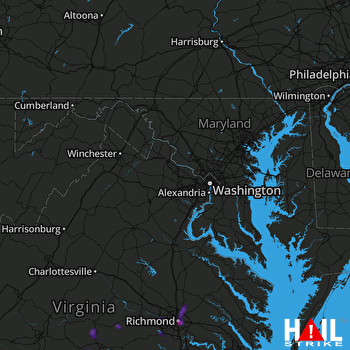
This weather event on June 15, 2025 includes:
1 states
20 counties,
16 cities,
and 62 zip codes.
There were total properties that were impacted and have possible damage.
States Impacted By Hail On June 15, 2025
Virginia
Counties Impacted By Hail On June 15, 2025
Brunswick, VA
·
Buckingham, VA
·
Chesterfield, VA
·
Cumberland, VA
·
Dinwiddie, VA
·
Goochland, VA
·
Greensville, VA
·
Hanover, VA
·
Henrico, VA
·
Isle of Wight, VA
·
Lunenburg, VA
·
Nottoway, VA
·
Orange, VA
·
Powhatan, VA
·
Prince Edward, VA
·
Prince George, VA
·
Richmond, VA
·
Southampton, VA
·
Surry, VA
·
Sussex, VA
Cities Impacted By Hail On June 15, 2025
Bon Air, VA
·
Brandermill, VA
·
Burkeville, VA
·
Chamberlayne, VA
·
Claremont, VA
·
Cumberland, VA
·
East Highland Park, VA
·
Glen Allen, VA
·
Goochland, VA
·
Highland Springs, VA
·
Lakeside, VA
·
Manchester, VA
·
Mechanicsville, VA
·
Montrose, VA
·
Richmond, VA
·
Woodlake, VA
Zip Codes Impacted By Hail On June 15, 2025
23060
·
23116
·
23899
·
23966
·
22942
·
22960
·
23005
·
23040
·
23059
·
23063
·
23069
·
23103
·
23111
·
23112
·
23113
·
23114
·
23120
·
23123
·
23139
·
23146
·
23153
·
23219
·
23220
·
23221
·
23222
·
23223
·
23224
·
23225
·
23227
·
23228
·
23230
·
23231
·
23235
·
23236
·
23238
·
23430
·
23824
·
23832
·
23838
·
23841
·
23842
·
23866
·
23867
·
23872
·
23876
·
23878
·
23881
·
23882
·
23888
·
23890
·
23891
·
23894
·
23901
·
23922
·
23930
·
23936
·
23942
·
23947
·
23954
·
23958
·
23960
·
24522
 STERLING (KLWX) RADAR

