This weather event on June 15, 2025 includes:
2 states
20 counties,
23 cities,
and 60 zip codes.
There were 233 total properties that were impacted and have possible damage.
States Impacted By Hail On June 15, 2025
Iowa
·
Minnesota
Counties Impacted By Hail On June 15, 2025
Buena Vista, IA
·
Calhoun, IA
·
Cerro Gordo, IA
·
Cherokee, IA
·
Clay, IA
·
Crawford, IA
·
Dickinson, IA
·
Floyd, IA
·
Hancock, IA
·
Humboldt, IA
·
Ida, IA
·
Kossuth, IA
·
O'Brien, IA
·
Osceola, IA
·
Plymouth, IA
·
Pocahontas, IA
·
Sac, IA
·
Sioux, IA
·
Webster, IA
·
Wright, IA
Cities Impacted By Hail On June 15, 2025
Alta, IA
·
Alton, IA
·
Aurelia, IA
·
Cherokee, IA
·
Denison, IA
·
Fonda, IA
·
Granville, IA
·
Larrabee, IA
·
Linn Grove, IA
·
Meriden, IA
·
Paullina, IA
·
Peterson, IA
·
Pocahontas, IA
·
Pomeroy, IA
·
Rembrandt, IA
·
Roseville, IA
·
Sanborn, IA
·
Schaller, IA
·
Sioux Rapids, IA
·
St. Benedict, IA
·
Storm Lake, IA
·
Twin Lakes, IA
·
Yetter, IA
Zip Codes Impacted By Hail On June 15, 2025
50468
·
50469
·
50483
·
50501
·
50510
·
50511
·
50516
·
50535
·
50540
·
50541
·
50551
·
50559
·
50560
·
50561
·
50563
·
50565
·
50571
·
50574
·
50575
·
50576
·
50579
·
50583
·
50585
·
50588
·
50598
·
50616
·
51002
·
51003
·
51005
·
51012
·
51014
·
51020
·
51022
·
51029
·
51033
·
51035
·
51037
·
51046
·
51047
·
51049
·
51050
·
51053
·
51058
·
51245
·
51248
·
51338
·
51345
·
51346
·
51347
·
51360
·
51433
·
51442
·
51449
·
51450
·
51458
·
51466
·
50401
·
50430
·
50525
·
51231
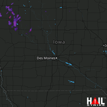 DES MOINES (KDMX) RADAR

